October 11, 2026 · 9 min read
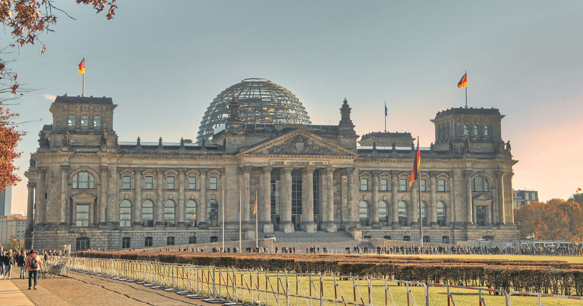
Amsterdam Anne Frank Walking Tour
From the Hollandsche Schouwburg through the old Jewish Quarter, past the Dockworker and the Dam, to the Anne Frank House on the Prinsengracht.
589
October 11, 2026 · 12 min read

 Freunde laufen kostenlos mit
Jede Tour wird in der App auch als geplante Gruppenrunde angeboten, der du dich anschließen kannst.
Zur Audiotour-Seite für Hiroshima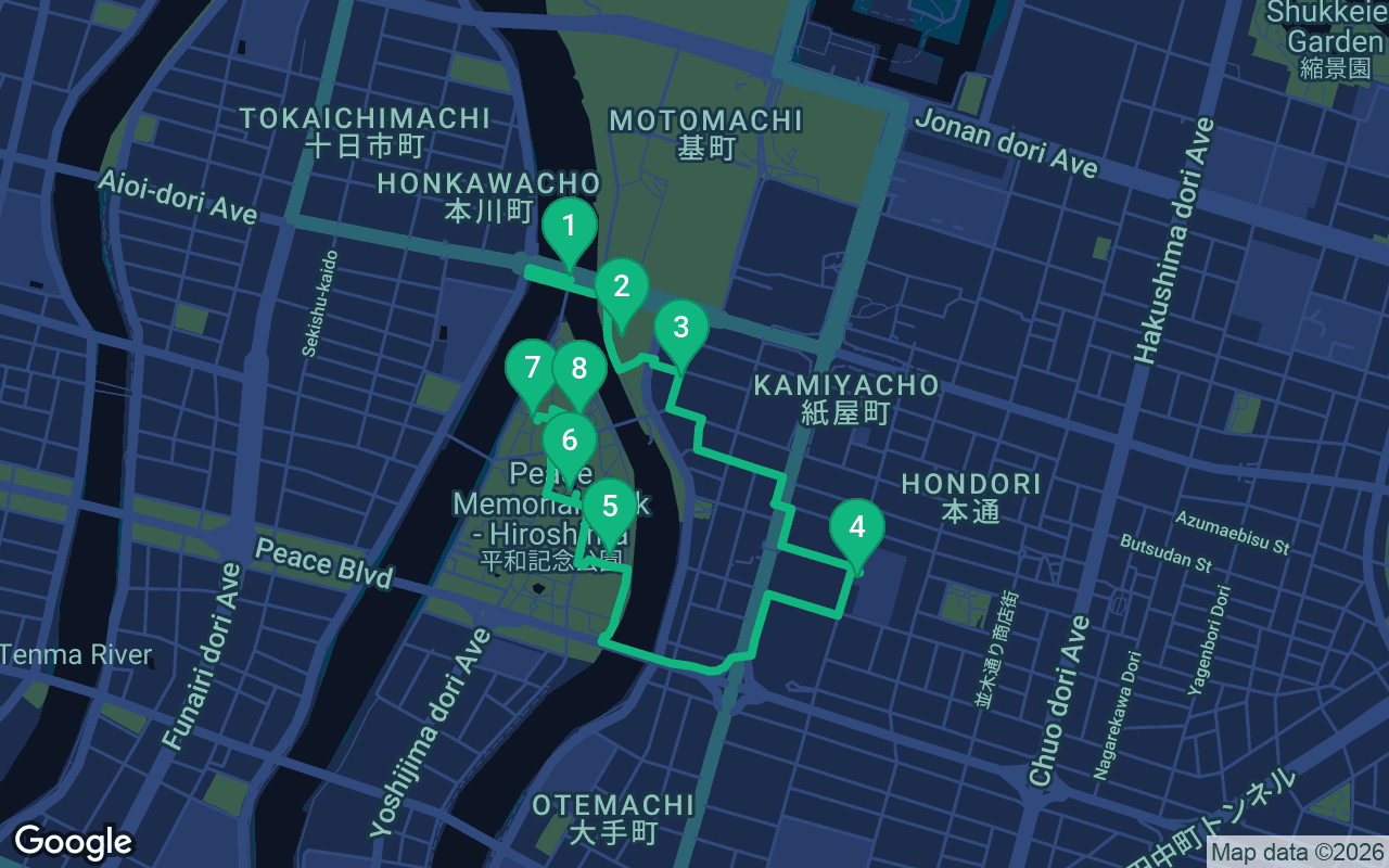
Etwa 2,6 km, ungefähr 36 Minuten in gemütlichem Tempo.
Diese Tour ist vertont
Klicke bei den ersten 3 Stationen auf Wiedergabe für eine 30-Sekunden-Vorschau der Erzählung. In der App hörst du die Einleitung und diese 3 Stationen kostenlos in voller Länge, und jede meldet sich mit einem Signalton, sobald du ankommst. Die gesamte geführte Tour gehört für einmalig $14.99 dauerhaft dir.
Funktioniert mit Garmin, Komoot, Strava, OS Maps und jeder GPX-App.
On the morning of August 6, 1945, about 350,000 people were in Hiroshima. At 8:15 am a single bomb exploded over the city. By the city's own estimate, roughly 140,000 people had died by the end of that year. This walk follows that morning and what came after, in the order it happened: the bridge the bomb was aimed at, the building that became the Dome, the spot beneath the explosion, a school where survivors searched for their families, trees that came back to life, and the memorials of the Peace Park, ending with a girl named Sadako and her paper cranes. It is one of our self-guided walking tours, about 2.6 kilometers, starting at the Genbaku Dome-mae tram stop and ending a short walk from the same stop. The tone is quiet. People come here to pray, so let the pauses be part of the walk.
The walking itself takes about 36 minutes. With time at each stop, allow around two hours, and more if you go inside the museums. The route is flat and paved, with one river crossing. Start at the Genbaku Dome-mae tram stop, at the east end of Aioi Bridge; the walk finishes in the north of the Peace Park, about 250 meters from that same stop. The Fukuromachi Elementary School Peace Museum is free and open in the daytime, and the main Peace Memorial Museum charges for entry; check hours before you go. If you can, start early enough to stand at the first stops near 8:15. On a hot day, carry water. At the Cenotaph and the Children's Peace Monument, people pray and leave offerings. Keep your voice low, and never touch or take the paper cranes.
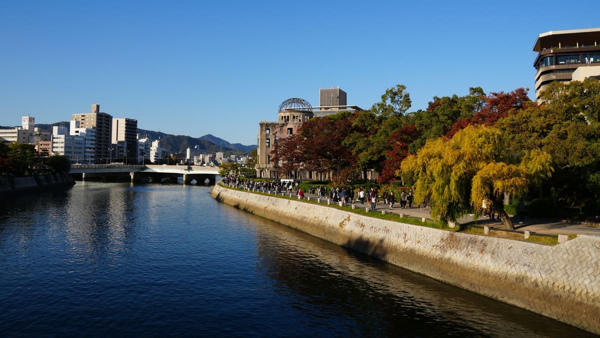
You're standing at the end of Aioi Bridge. Look along it and you'll see what makes it unusual: it isn't a straight crossing but a T. A stem branches off the middle of the bridge and runs south onto the tip of the island that is now the Peace Park. That extra arm was added in 1934.
From the air, that shape was easy to pick out. It is why this bridge was chosen as the aiming point. Many people assume the Dome you can see nearby was the target. It wasn't. The crew aimed for this T.
The plane was a B-29 named Enola Gay. The bomb was called Little Boy, a uranium bomb. At 8:15 in the morning it exploded over the city. It missed this bridge by a few hundred meters and burst above a hospital you'll stand beside in a few minutes.
The bridge in front of you is not the one from 1945. It was rebuilt in 1983, with granite for its railings and main pillars. But look down toward its base: pillars from the original bridge, damaged by the blast, have been kept there.
Now look south down the riverbank to the bare frame of a dome. Walk toward it along the east bank of the river, keeping the water on your right. It's about two minutes.
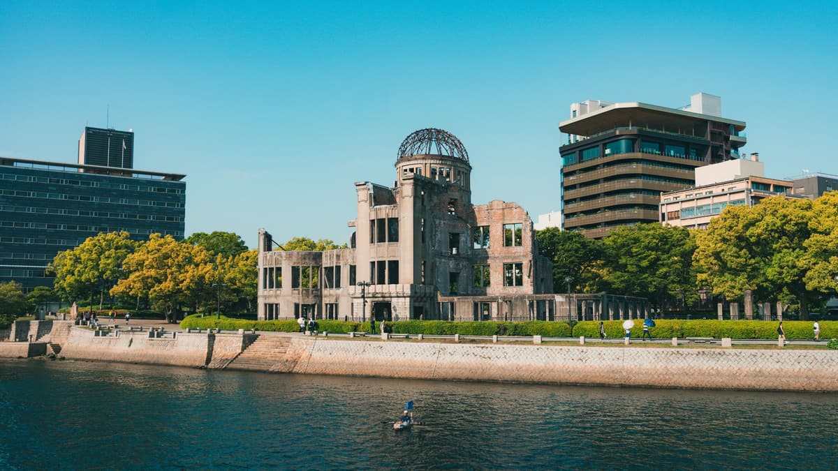
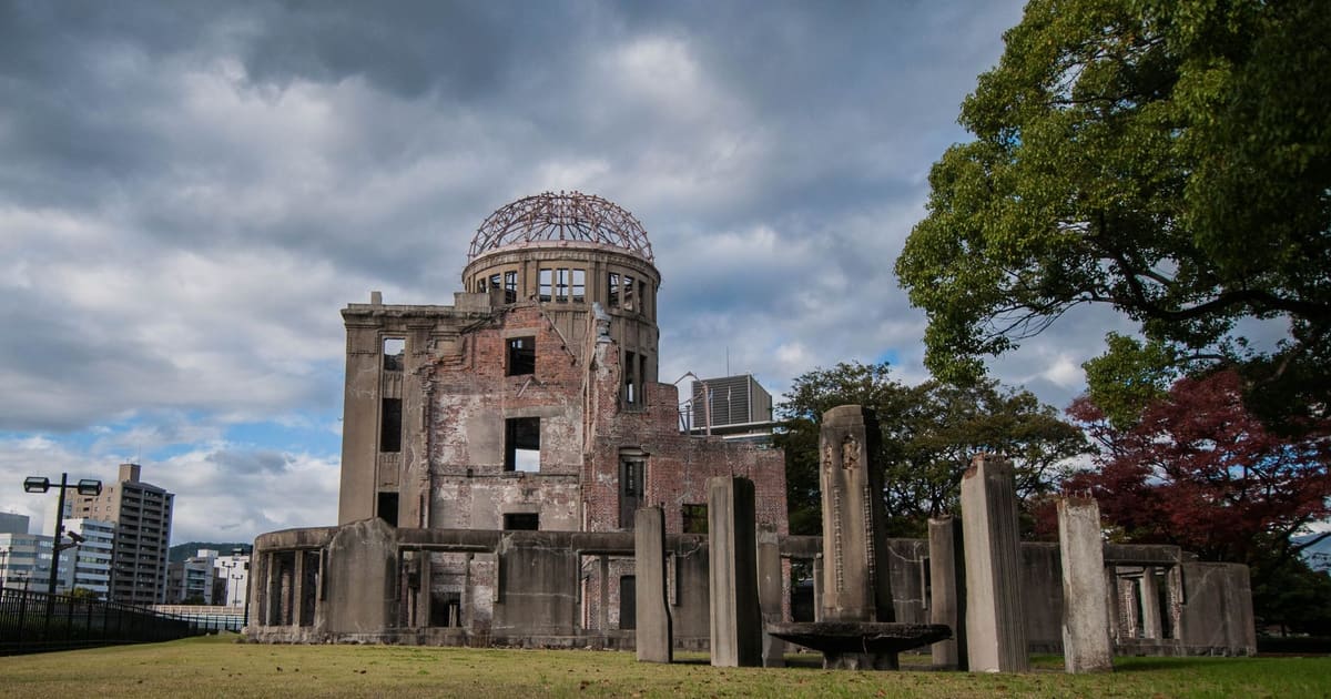
Stand at the fence and look up at the oval dome, now just a skeleton of steel. Today it is a World Heritage Site.
A Czech architect, Jan Letzel, designed it, and it was completed in April 1915 as the Prefectural Commercial Exhibition Hall, a hall for showing the prefecture's goods. In 1933 it was renamed the Industrial Promotion Hall. By 1945 it held wartime government offices, including timber control offices.
The bomb exploded about 160 meters southeast of this building and high above the ground. Because the blast came from almost directly overhead, the central part of the hall stayed standing, with the frame of its dome. The city records it simply: everyone working in the building at the time died.
In 1966 the City Council resolved to preserve it, and a public fundraising campaign paid for the first preservation work the next year. In December 1996 it was added to the World Heritage list.
As you walk on, remember the Dome's shape. At the Cenotaph later, you'll see it again, framed from across the park.
Now turn your back to the river and take the small street that runs east, away from the water, just south of the Dome. In about two minutes you'll reach a modern hospital with a small plaque on the pavement out front.
Find the small plaque on the pavement in front of Shima Hospital. Stand beside it and look straight up. About 600 meters above you is where the bomb exploded at 8:15. This is the hypocenter, the point on the ground directly beneath it.
In 1945 the Shima Hospital was a two-storey brick building, built in 1933. About 80 patients, nurses and others inside died. The hospital's director was away that morning, visiting a patient, and he survived. Today a modern hospital stands on the same ground.
How do we know the spot? Scientists worked it out afterwards by plotting on a map the direction of shadows the heat had burned onto surfaces around the city. Where those lines crossed, they placed the hypocenter.
A short way southwest of here, across the river at the park end of Motoyasu Bridge, stands a low building that is today the park's Rest House. The buildings around you hide it from this spot. In 1945 it was the Taishoya kimono shop, built in 1929, and it stood about 170 meters from where you're standing now. Thirty-seven people were working in it that morning. Only one survived: a man working there who had gone down to the basement to fetch documents. That basement is still there, preserved inside the Rest House, which has served the park since 1982. If you want to see it, it's a short detour at the end of the walk.
Thirty-seven people at work, and one alive, because he happened to be in the basement at 8:15.
Next, a school where survivors went looking for their families. Head south from the hospital, then east through the city blocks, toward the Fukuromachi neighborhood. It's about seven or eight minutes.
Was enthalten ist
Unsere Touren sind meditativ und immersiv gedacht: Du bleibst in Bewegung und hörst einfach zu. Gemeinsam sind sie immer schöner, und die App spielt die Erzählung synchron ab, sodass du, dein Partner und deine Freunde jede Station im selben Moment hören.
You're at Fukuromachi Elementary School. Part of its old West Building has been kept as a small peace museum.
Der Rest dieser Station steckt in der vollständigen Audiotour.
Beside the museum's East Building you'll find a small group of trees. They are Chinese parasol trees, called aogiri in Japanese, and they carry one of the quieter stories of that year.
Der Rest dieser Station steckt in der vollständigen Audiotour.
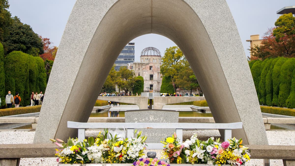
Stand in front of the arch, facing north. Look through it.
Der Rest dieser Station steckt in der vollständigen Audiotour.
This stone monument rests on the back of a stone turtle and is crowned with carved dragons. It remembers the Korean victims of the bomb.
Der Rest dieser Station steckt in der vollständigen Audiotour.
Here at the Children's Peace Monument, look up. At the top of this 9-meter monument, a girl lifts a golden crane over her head.
Der Rest dieser Station steckt in der vollständigen Audiotour.
Mach diesen Spaziergang zusammen mit anderen bei der nächsten geplanten Tour.
Ca. 2,6 km, etwa 36 Minuten bei gemütlichem Tempo · 8 Stopps
Freunde laufen kostenlos mitOctober 11, 2026 · 9 min read
From the Hollandsche Schouwburg through the old Jewish Quarter, past the Dockworker and the Dam, to the Anne Frank House on the Prinsengracht.
October 11, 2026 · 11 min read
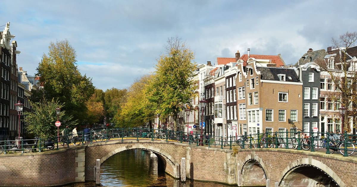
From Van Houten's street by the Vondelpark past Leidseplein, the Rijksmuseum passage and the famous canal bench to the Anne Frank House.
October 11, 2026 · 10 min read
Follow the last days of April and May 1945 from the Anhalter Bahnhof ruin past the Gestapo site and Brandenburg Gate to the Moltke Bridge and the Reichstag.