October 11, 2026 · 9 min read
Amsterdam Anne Frank Walking Tour
From the Hollandsche Schouwburg through the old Jewish Quarter, past the Dockworker and the Dam, to the Anne Frank House on the Prinsengracht.
589
October 9, 2026 · 10 min read

 A barátaid ingyen sétálnak
Minden túra ütemezett csoportos sétaként is fut, amelyhez csatlakozhatsz az appban.
További hangos túrák itt: Melbourne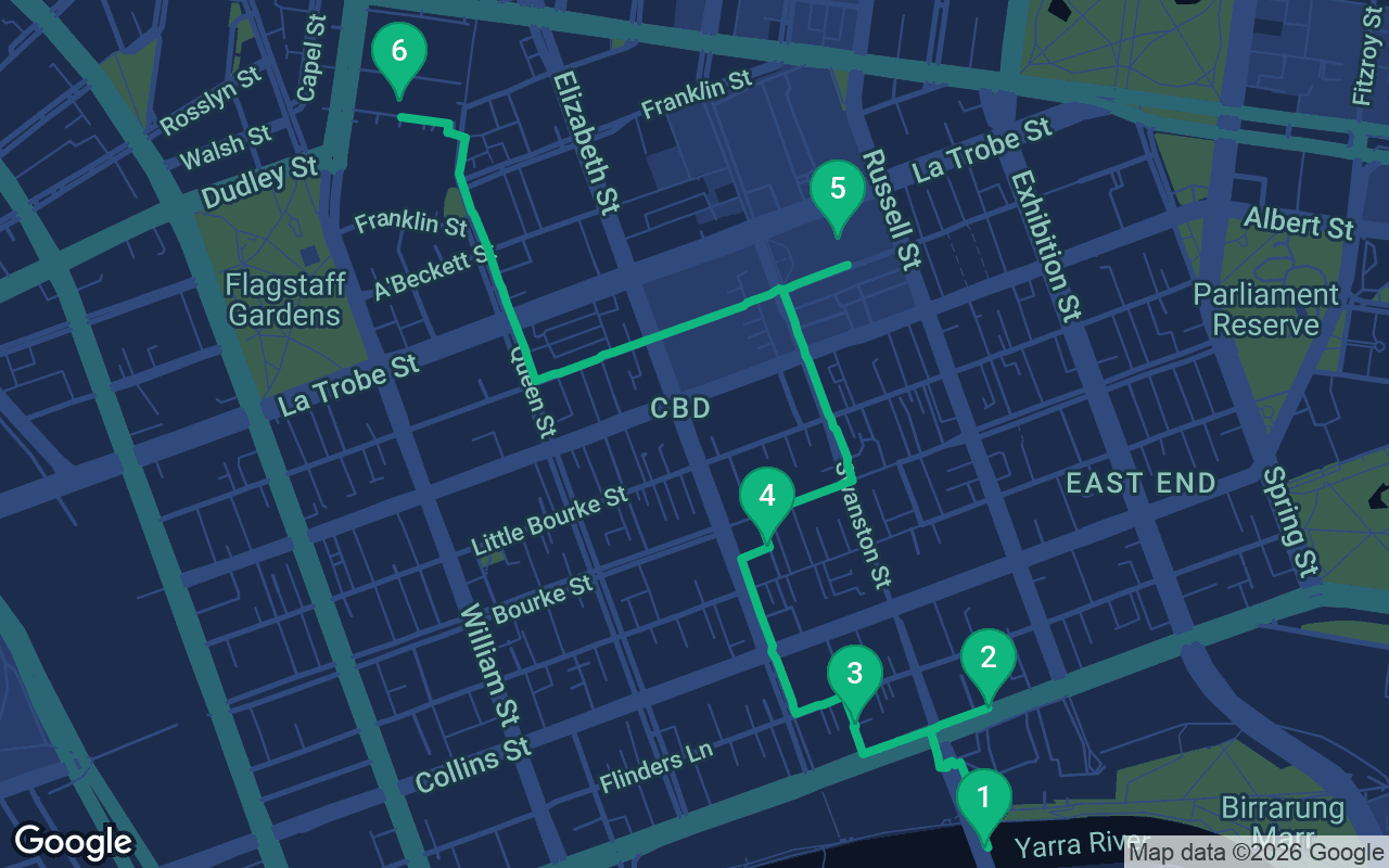
Nagyjából 3 km, körülbelül 44 perc kényelmes tempóban.
Ez a séta hangosvezetéssel is elérhető
Nyomj a lejátszásra az első 3 megállónál, és itt helyben meghallgathatsz egy 30 másodperces részletet a narrációból. Az alkalmazásban a bevezető és ez a 3 megálló teljes hosszában ingyenes, és mindegyik hangjelzéssel szól, amint megérkezel. A teljes narrált túra mindössze $8.99 összegért a tiéd lehet, ami egy egyszeri, örökre szóló vásárlás.
Működik Garmin, Komoot, Strava, OS Maps és bármilyen GPX alkalmazással.
Melbourne keeps its best secrets in its back lanes. The city center was laid out in 1837 as a neat grid of broad streets, with narrow service lanes squeezed between them for carts and deliveries, and over the last few decades those lanes and the Victorian arcades that cut through the blocks have become the city's living room, full of coffee, small bars and street art. This walk threads through them from the river to the market, starting on Princes Bridge over the Birrarung, the river most people know as the Yarra, and ending at Queen Victoria Market. The city stands on the Country of the Wurundjeri Woi-wurrung and Bunurong peoples of the Kulin nation. The route is about two and a half kilometers, flat for most of the way, and it is one of the most enjoyable self-guided walking tours you can do in an Australian city, because so much of it happens under cover and at the pace of a coffee.
Allow about two hours at a stroll, more if you stop for coffee, browse the arcades or linger in the library, and you should. The route is paved and mostly flat, with only a gentle rise as you head north from the river. Melbourne's weather is famously changeable, and locals joke about four seasons in one day, so carry a light layer even in summer. Much of the middle section runs through lanes and covered arcades, but the bridge, the streets between the lanes and the walk up to the market are exposed, and the Australian sun is strong, so bring a hat, sunscreen and water on any bright day. The lanes are busiest at weekday lunchtime and quietest early in the morning, though some cafes and shops will not yet be open then. The State Library and Queen Victoria Market keep their own hours, and the market is closed on some days of the week, so check before you go. Plan to arrive at the market hungry.
Stand in the middle of Princes Bridge, on the side facing downstream, and look out over the water. This is the Birrarung, the name the Wurundjeri gave the river long before the British arrived. The name Yarra seems to have come from a misunderstanding in the 1830s, when a surveyor took a word for a waterfall as the name of the river. That waterfall matters. A short way downstream, roughly where Queen Street meets the river today, a natural ledge of rock once held back the tide, keeping the water above it fresh. Wurundjeri and other Kulin people gathered along these banks for generations, and in 1835 the first settlers from Van Diemen's Land chose this spot for the same reason: fresh water. That same year John Batman claimed to have bought a huge swathe of land around the bay from Wurundjeri elders in exchange for blankets, knives, flour and other goods. The colonial government declared his treaty void within months, not because it was unfair, but because it held that the land already belonged to the Crown. The rock ledge was blasted away in the 1880s to help river traffic. Now turn and look north. The long, ochre building with the copper dome and the row of clocks over its entrance is Flinders Street Station, finished in 1910, and for generations Melburnians have arranged to meet under the clocks. The bridge you are standing on opened in 1888, replacing an earlier stone arch. To reach the next stop, walk north off the bridge to the big intersection at Flinders Street and cross at the lights. The cathedral is on the far right-hand corner, about three minutes away.
 Stand on the corner and look up at St Paul's, the Anglican cathedral, whose Gothic Revival spires rise over one of the busiest intersections in the city. Across the road are the station, Federation Square and an old pub, and trams clang past in both directions, yet the cathedral manages to feel calm. It was designed by William Butterfield, one of the leading church architects of Victorian England, who drew the plans in London and never came to Australia to see them built. He fell out with the local church authorities and resigned before the building was finished, and it was consecrated in 1891. The spires came much later, in the 1920s and 1930s, built by another architect to a different design from the one Butterfield had drawn. If the doors are open, step inside. Butterfield loved color, and the walls are striped in bands of contrasting stone, with tiled floors and mosaics that glow in the light from the windows. It is one of the most richly decorated interiors in the city. Outside, look for the statue of Matthew Flinders, the navigator who sailed right round the continent in the early 1800s and championed the name Australia. To reach the next stop, walk west along Flinders Street, with the station on the opposite side of the road, for about three minutes. Turn right into Degraves Street, the narrow lane with tables spilling out of every doorway.
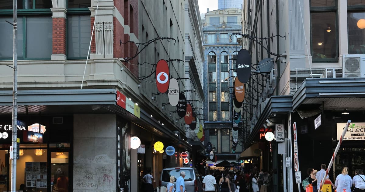
You are in Degraves Street, a short, narrow lane packed with cafe tables, umbrellas and the smell of coffee, and it is the picture most people have of Melbourne's laneways. It was not always like this. For much of the twentieth century, lanes like this were back alleys for deliveries and rubbish bins, and the city center emptied out after office hours. From the 1990s the city council set out to bring people back to live and spend time in the center, and small businesses moved into the cheap, overlooked spaces along the lanes. The coffee culture came from further back. Italian and Greek migrants who settled in Melbourne after the Second World War brought espresso with them, and the city took to it with a passion it has never lost. Today Melburnians are proud, sometimes fiercely so, of their coffee, and a flat white in one of these lanes is close to a local ritual. Look for the stairs at the Flinders Street end of the lane leading underground. They take you into a pedestrian subway lined with pink tiles that was built in the 1950s to move crowds to the station, around the time Melbourne hosted the 1956 Olympic Games. Now walk north up Degraves Street, cross Flinders Lane, and carry straight on into Centre Place, an even narrower lane covered in posters and paint. At Collins Street, cross over and follow the covered passages of the Block Arcade north to Little Collins Street. The Royal Arcade is just across the road, about six minutes from here.
Mit tartalmaz
Túráink meditatívnak és magával ragadónak készültek: mozogsz, és egyszerűen hallgatod. Együtt mindig jobbak, és az alkalmazás szinkronban játssza le a narrációt, így te, a párod és a barátaid ugyanabban a pillanatban hallhatjátok az egyes megállókat.
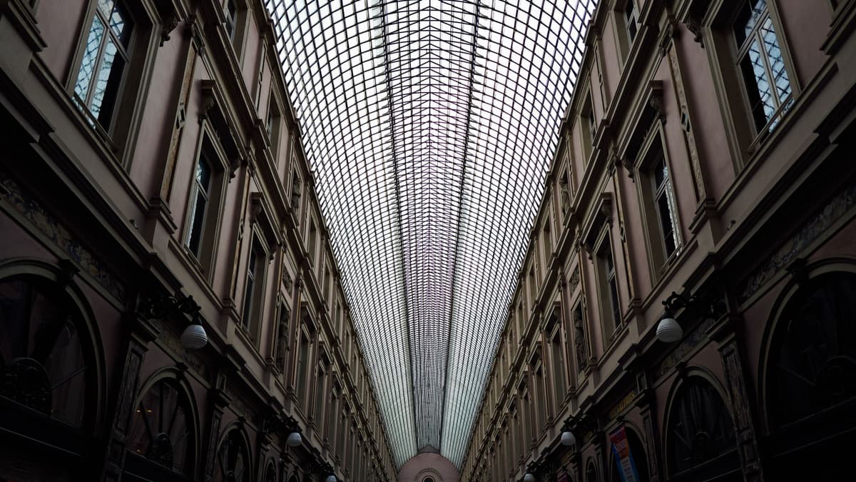
You have just come through the Block Arcade, with its mosaic floors and glass roof, built in the 1890s for the people who came to promenade along Collins Street, a fashionable ritual known as doing the Block.
A megálló folytatása a teljes hangos túrában hallható.
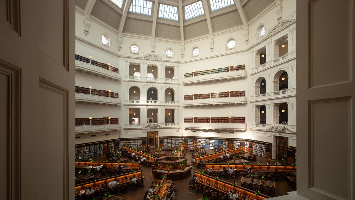
Stand on the lawn in front of the library and look up at the portico and the dome rising behind it.
A megálló folytatása a teljes hangos túrában hallható.
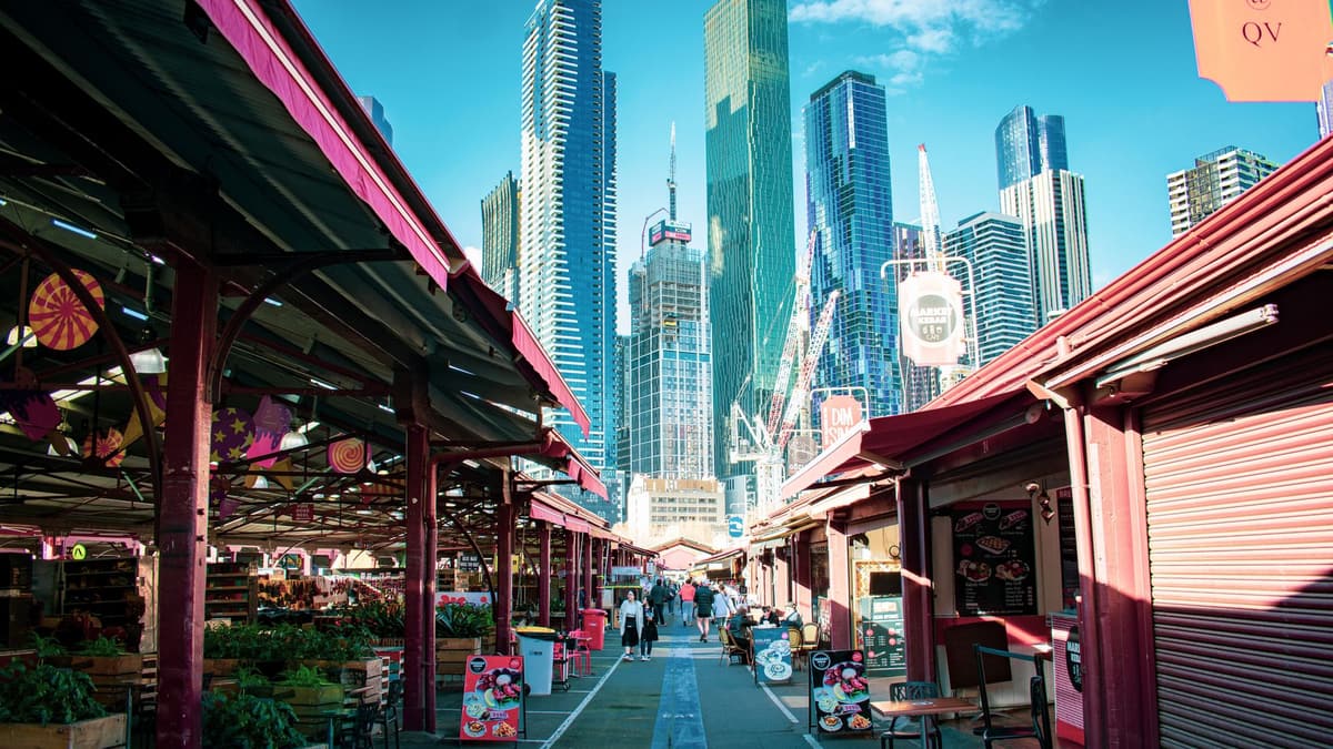
You have reached Queen Victoria Market, and the long rows of open sheds and old halls stretch away in front of you.
A megálló folytatása a teljes hangos túrában hallható.
Tedd meg ezt a sétát másokkal a következő tervezett túrán.
Körülbelül 3 km, nagyjából 44 perc kényelmes tempóban · 6 megálló
A barátaid ingyen sétálnakOctober 11, 2026 · 9 min read
From the Hollandsche Schouwburg through the old Jewish Quarter, past the Dockworker and the Dam, to the Anne Frank House on the Prinsengracht.
October 11, 2026 · 11 min read
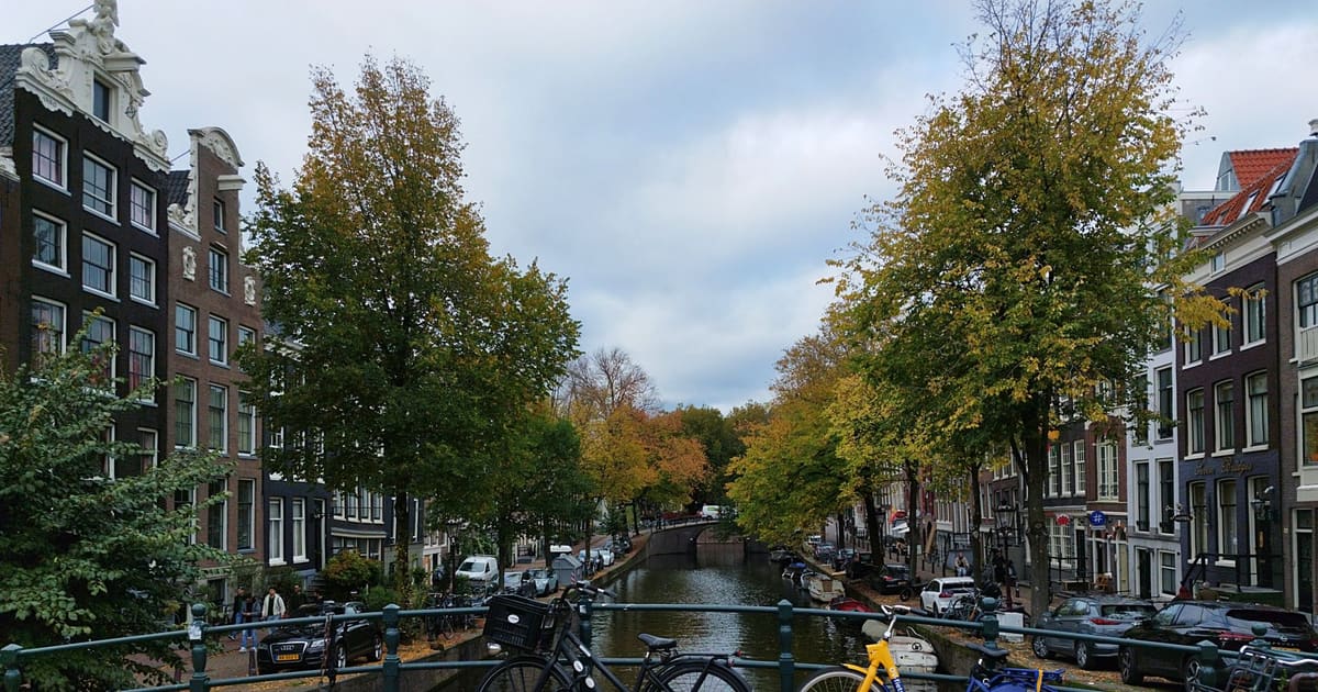
From Van Houten's street by the Vondelpark past Leidseplein, the Rijksmuseum passage and the famous canal bench to the Anne Frank House.
October 11, 2026 · 10 min read
Follow the last days of April and May 1945 from the Anhalter Bahnhof ruin past the Gestapo site and Brandenburg Gate to the Moltke Bridge and the Reichstag.