October 11, 2026 · 9 min read
Amsterdam Anne Frank Walking Tour
From the Hollandsche Schouwburg through the old Jewish Quarter, past the Dockworker and the Dam, to the Anne Frank House on the Prinsengracht.
589
October 9, 2026 · 10 min read

 Gli amici camminano gratis
Ogni tour funziona anche come camminata di gruppo programmata a cui puoi unirti nell'app.
Altri tour audio a Auckland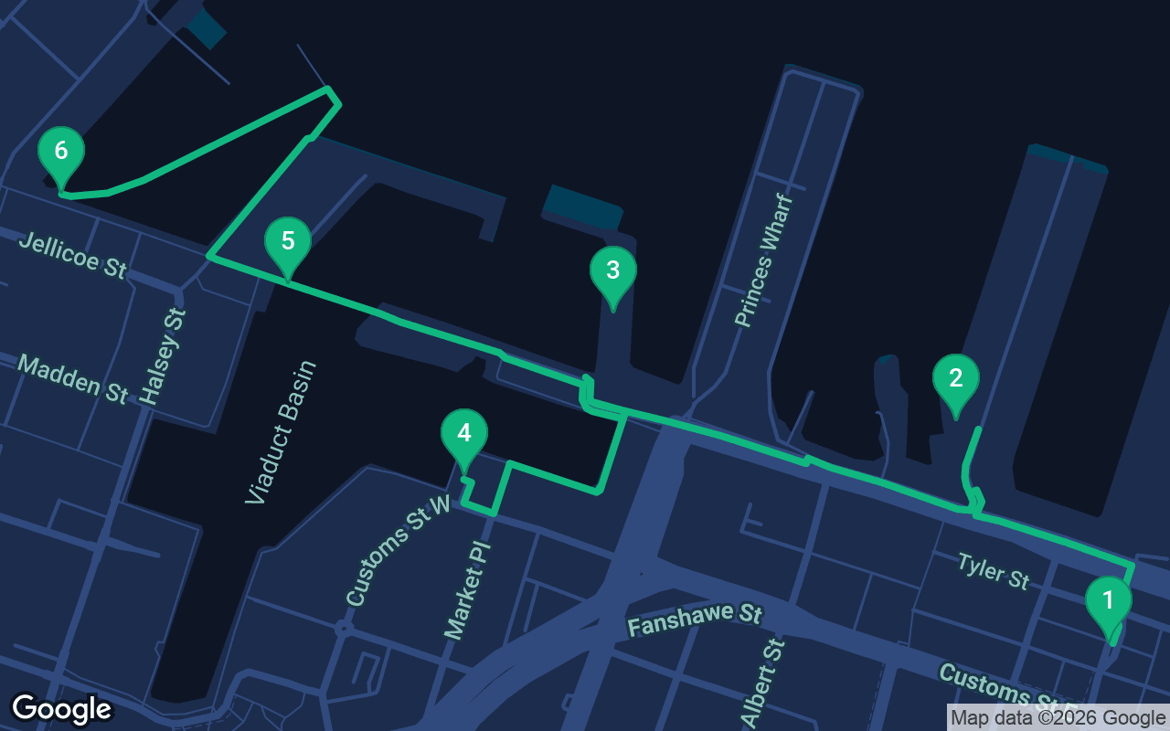
Circa 2,6 km, più o meno 40 minuti a passo tranquillo.
Questo tour è narrato
Premi play sulle prime 3 tappe per ascoltare una demo di 30 secondi della narrazione. Nell'app, l'introduzione e queste 3 tappe sono gratis e complete, e ogni tappa ti avvisa con un segnale acustico al tuo arrivo. L'intero tour narrato sarà tuo a $8.99, un acquisto unico che conservi per sempre.
Funziona con Garmin, Komoot, Strava, OS Maps e qualsiasi app GPX.
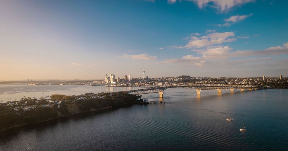
Auckland calls itself the City of Sails, and the nickname is earned along the stretch of shore you are about to walk. Tāmaki Makaurau, as the city is known in te reo Māori, grew up on the edge of the Waitematā Harbour, and almost everything that made it, from the first flag raised by the colonial government to the yachts that twice brought the America's Cup home, happened within a few minutes of the water. This walk starts at Britomart, the old warehouse quarter around the city's main train station, follows the wharves west past the ferries and cruise ships, circles the marina built for the America's Cup and crosses a lifting bridge to finish among the fishing boats of North Wharf. It is a little over two kilometers, about a mile and a half, flat all the way and mostly free of cars, which makes it one of the easiest self-guided walking tours in New Zealand.
Allow an hour and a half at a stroll, and two or three hours if you go into the Maritime Museum, which deserves at least an hour on its own. The route is level and paved from start to finish, so it suits strollers and wheelchairs, though a few of the boardwalks are uneven timber. There is very little shade along the water. Auckland's sun is fierce even on mild days, so bring a hat and sunscreen, and pack a light rain jacket too, because the weather here changes quickly and a sunny morning can turn to a shower by lunch. The harbor is breezy almost every day, which is lovely in summer and chilly in winter. Wynyard Crossing, the bridge near the end, lifts several times a day to let boats through, and when it does you will wait a few minutes on the bank, which is part of the fun. The museum keeps its own hours and charges admission, so check before you go. Late afternoon is a fine time to walk, because you finish at North Wharf just as the restaurants fill up and the light turns gold over the harbor.
You start in Britomart, the grid of restored brick and stone warehouses around Waitematā station, the city's main railway station. Stand in front of the station itself, the grand building with the columns. It opened in 1912 as Auckland's Chief Post Office, and the trains only moved in beneath it in 2003. Until recently this was the end of the line. In September 2026 the City Rail Link opened, running tunnels under the city center and turning the old terminus into a through station. The name Britomart belongs to a headland that is no longer here. Point Britomart rose just east of this spot, a cliff-edged point known to Māori as Te Rerenga Ora Iti, often translated as the leap of the few survivors, and it was an important pā for centuries. On 18 September 1840 the Union Jack was raised on the point to mark the founding of Auckland as the new capital, on land that the Ngāti Whātua chief Āpihai Te Kawau had offered to Governor William Hobson. Ngāti Whātua Ōrākei describe that offer as a tuku, a gift meant to bind the two peoples together, and within a few generations nearly all of their land was gone. The British built Fort Britomart on the headland, and later the whole point was quarried away to fill in the bays along the shore. The ground under your feet is reclaimed land. The warehouses went up on it in the late 1800s and early 1900s, and many now hold shops, bars and offices. Walk north to Quay Street, cross at the lights and head left toward the long wharf straight ahead, about five minutes.
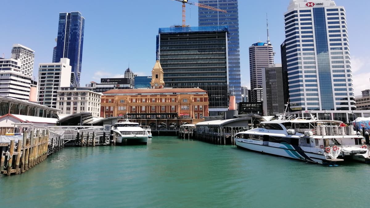 Queens Wharf runs straight out into the harbor from the foot of Queen Street, and for most of the twentieth century it was the busiest working wharf in the city. It was built between 1907 and 1913, and five big cargo sheds stood along it, full of the frozen lamb, beef and butter that New Zealand sent to Britain. Only one survives, Shed 10, a long timber and steel building from 1910 that now serves as a cruise terminal and events space. Further out stands The Cloud, the long white building with the wavy roof, put up as a fan zone for the 2011 Rugby World Cup and kept as a venue afterward. The government and the council bought the wharf jointly in 2009 so that Aucklanders could walk on it, and before that most of it was closed to the public. Wharves like this were also the scene of some of the hardest labor fights in the country's history. In 1951 the waterside workers' dispute shut ports across New Zealand for months, and it still marks the politics of the waterfront. Look east and you will see the Ferry Building, a handsome brick and sandstone building from 1912, where ferries leave for Devonport, Waiheke Island and the harbor's other shores. Look out to sea for Rangitoto, the low, even cone of the youngest volcano in the Auckland field, which rose from the harbor only about six hundred years ago. Walk back to Quay Street, turn right and follow it west past Princes Wharf and its hotel to the museum on the corner of the marina, about seven minutes.
The New Zealand Maritime Museum sits on Hobson Wharf at the edge of the marina, and its Māori name, Hui Te Ananui a Tangaroa, means the dwelling of Tangaroa, the atua of the sea. It tells the story of a country whose first peoples and early settlers all arrived by sea. The galleries begin with the Polynesian navigators who found these islands around seven or eight hundred years ago, crossing thousands of kilometers of open Pacific by reading the stars, the swells and the flight of birds. They move on through the whalers, the immigrant ships and the coastal traders that carried almost everything before there were decent roads. The showpiece hangs in the gallery at the northern end. NZL 32, the yacht known as Black Magic, won the America's Cup off San Diego in 1995, beating the defender five races to nil and taking the cup out of the United States for only the second time in its history. The campaign was led by Sir Peter Blake, and the country went mad for the lucky red socks he wore, buying them in their thousands. Blake was killed by pirates on the Amazon in 2001, while leading an environmental expedition, and the gallery around the yacht honors him. The museum also keeps heritage boats moored outside, and some of them take passengers out on the harbor when sailings are running. When you are ready, follow the boardwalk around the edge of the marina, heading south and then west along the water to the far corner of the basin, about five minutes.
Cosa è incluso
I nostri tour sono pensati per essere meditativi e immersivi: ti muovi e semplicemente ascolti. Sono sempre più belli in compagnia, e l'app riproduce la narrazione in sincronia, così tu, il tuo partner e i tuoi amici sentite ogni tappa nello stesso momento.
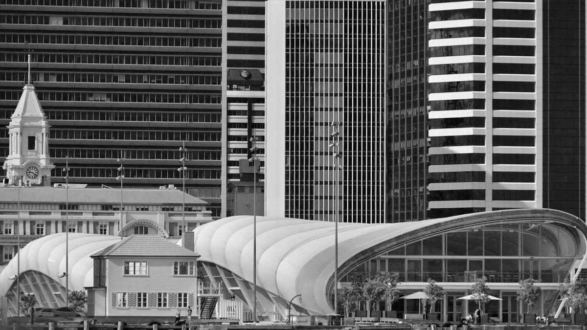
Viaduct Harbour is the marina in front of you, ringed with apartments, bars and restaurants, and moored with some of the largest private yachts you are likely to see. It was not always this glamorous.
Il resto di questa tappa è nel tour audio completo.
Wynyard Crossing is the pedestrian and cycle bridge across the mouth of the marina, linking Te Wero Island with the Wynyard Quarter on the far side. It looks modest, but it is a small piece of engineering theater.
Il resto di questa tappa è nel tour audio completo.
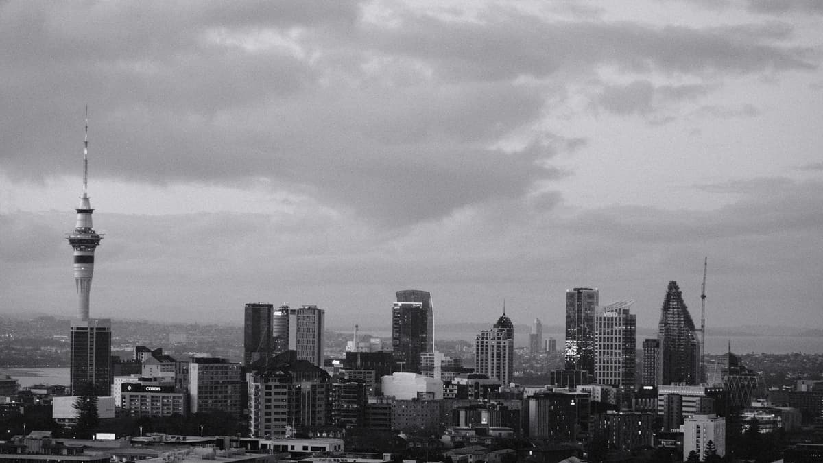
North Wharf is where the walk ends, a long timber promenade lined with old fishing industry sheds that now hold seafood restaurants and bars.
Il resto di questa tappa è nel tour audio completo.
Fai questa camminata in compagnia alla prossima uscita in programma.
Circa 2,6 km, circa 40 minuti a passo lento · 6 tappe
Gli amici camminano gratisOctober 11, 2026 · 9 min read
From the Hollandsche Schouwburg through the old Jewish Quarter, past the Dockworker and the Dam, to the Anne Frank House on the Prinsengracht.
October 11, 2026 · 11 min read
From Van Houten's street by the Vondelpark past Leidseplein, the Rijksmuseum passage and the famous canal bench to the Anne Frank House.
October 11, 2026 · 10 min read
Follow the last days of April and May 1945 from the Anhalter Bahnhof ruin past the Gestapo site and Brandenburg Gate to the Moltke Bridge and the Reichstag.