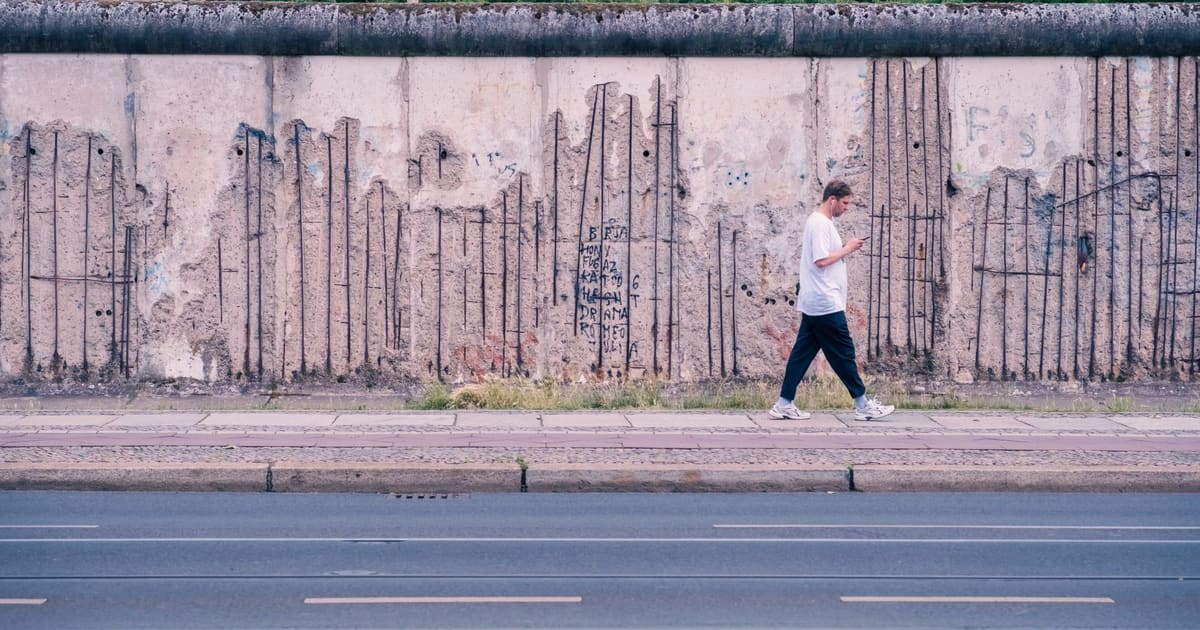
October 11, 2026 · 9 min read
Amsterdam Anne Frank Walking Tour
From the Hollandsche Schouwburg through the old Jewish Quarter, past the Dockworker and the Dam, to the Anne Frank House on the Prinsengracht.
589
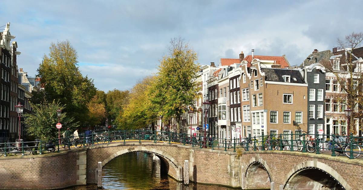
October 11, 2026 · 10 min read

 친구는 무료로 함께 걸어요
모든 투어는 앱에서 참여할 수 있는 정기 그룹 걷기 모임으로도 운영됩니다.
Berlin의 오디오 투어 더 보기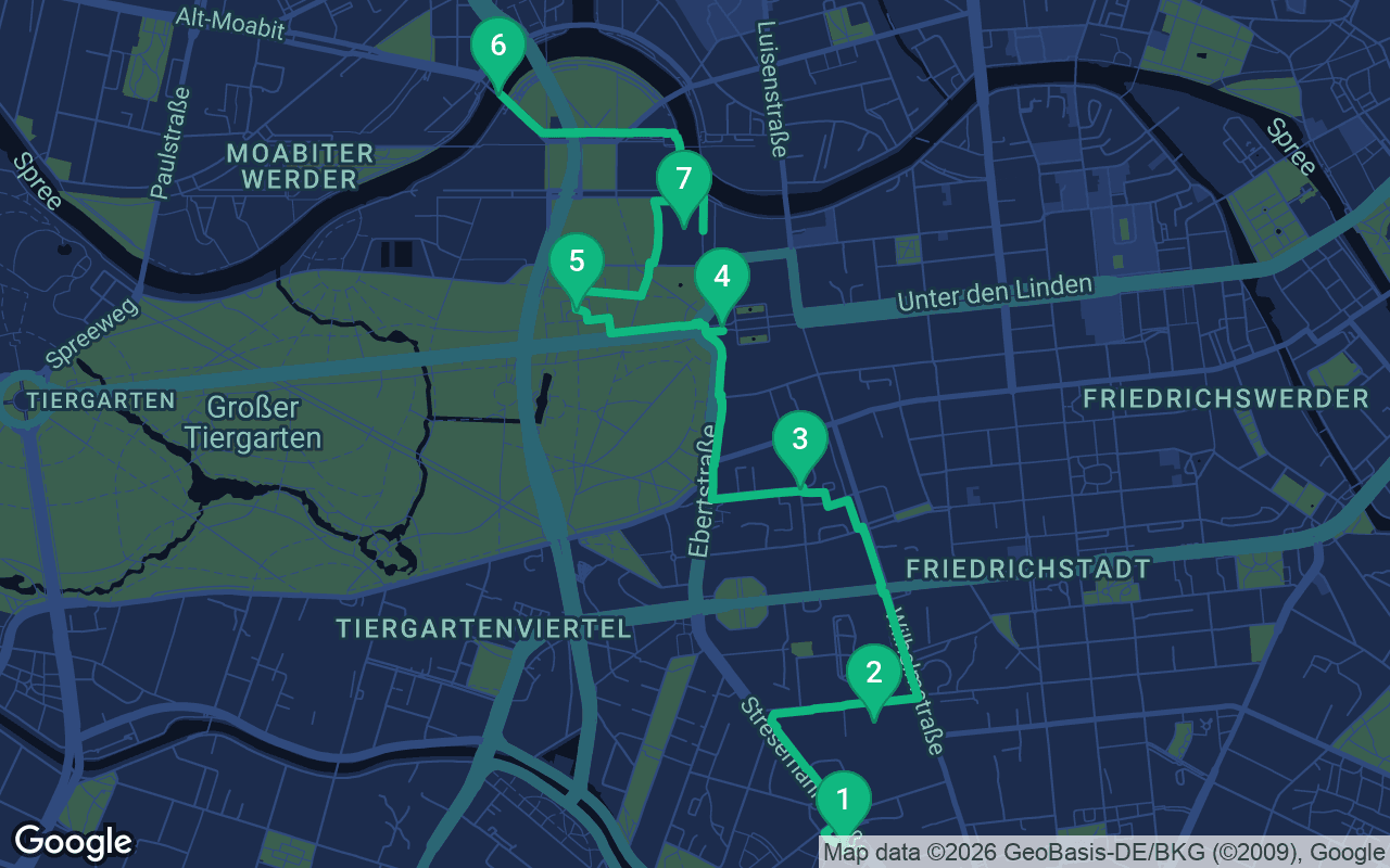
약 5.1km, 여유로운 페이스로 대략 70분 소요.
음성 가이드가 포함된 투어입니다
처음 3개 스톱에서 재생을 누르면 여기에서 나레이션을 30초 데모로 들을 수 있습니다. 앱에서는 인트로와 이 스톱들을 무료로 끝까지 들으실 수 있으며, 각 스톱에 도착하면 알림음이 울립니다. 전체 오디오 투어는 $16.99에 한 번만 구매하시면 평생 소장하실 수 있습니다.
Garmin, Komoot, Strava, OS Maps 및 모든 GPX 앱과 호환됩니다.
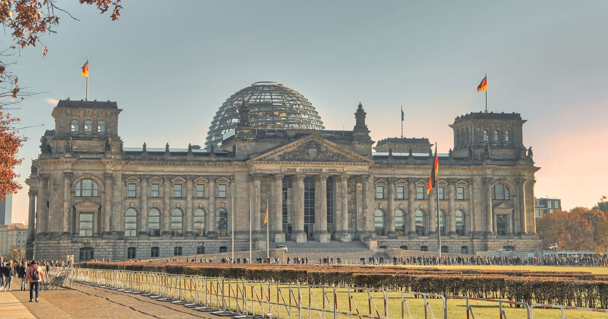
On 16 April 1945 the Soviet army opened its offensive on Berlin. About two and a half million Red Army soldiers faced roughly a million German soldiers, Waffen-SS and men of the Volkssturm militia. By the last week of April the fighting had reached the government quarter in the heart of the city. This walk follows those last days through the streets where they happened, from south to north. You start at the ruin of the Anhalter Bahnhof, pass the old Gestapo headquarters, the place where the regime ended, the Brandenburg Gate and the Soviet war cemetery in the Tiergarten, cross toward the Moltke Bridge, and finish at the Reichstag. It runs about five kilometers. Of all our self-guided walking tours, this is one of the most sober. It is about the people of the city, the soldiers and the prisoners, not the men who started the war.
The walking takes a little over an hour; with the stories, allow two to two and a half. It is flat and paved all the way, with one shaded stretch along the edge of the Tiergarten park. Start at Anhalter Bahnhof station on the S-Bahn, right beside the ruin. The walk ends at the Reichstag, close to Bundestag station on the U5 and to Brandenburger Tor station. The Topography of Terror documentation center is free; check its opening hours before you go. Visiting the inside of the Reichstag needs advance registration on the Bundestag website, so book a guided tour ahead if you want to see the soldiers' writing on the walls; a dome-only visit doesn't include it. The Soviet memorial is a cemetery, so please treat it as one.
In front of you stands a free-standing portico with three arches, and nothing behind it. Look up for the figures of Day and Night. This was the entrance to one of Berlin's great railway stations.
The station was badly damaged in 1945. It closed later, and in 1959 and 1960 it was blown up, despite public protest. Only this fragment was kept.
Now look along Schöneberger Strasse for the tall bunker nearby. That is the Anhalter bunker. Forced laborers built it in 1942, for 3,500 people. By the end of the war, about 12,000 people were sheltering inside it. Picture that: more than three people for every place it was built for, packed together underground while the front came closer.
Under the canal just south of here runs the north-south S-Bahn tunnel. In the first days of May it was blown up beneath the Landwehr canal, and flooded. That much is certain. Almost everything else is still argued over. Some accounts say 1 May, others 2 May. The old official version blamed SS units; a troop diary and a newspaper report from June 1945 point to army engineers. When the tunnel was drained in 1946, about ninety bodies were recovered. How many really died there, we still do not know.
Follow Stresemannstrasse north, then turn right into Niederkirchnerstrasse, about eight minutes.
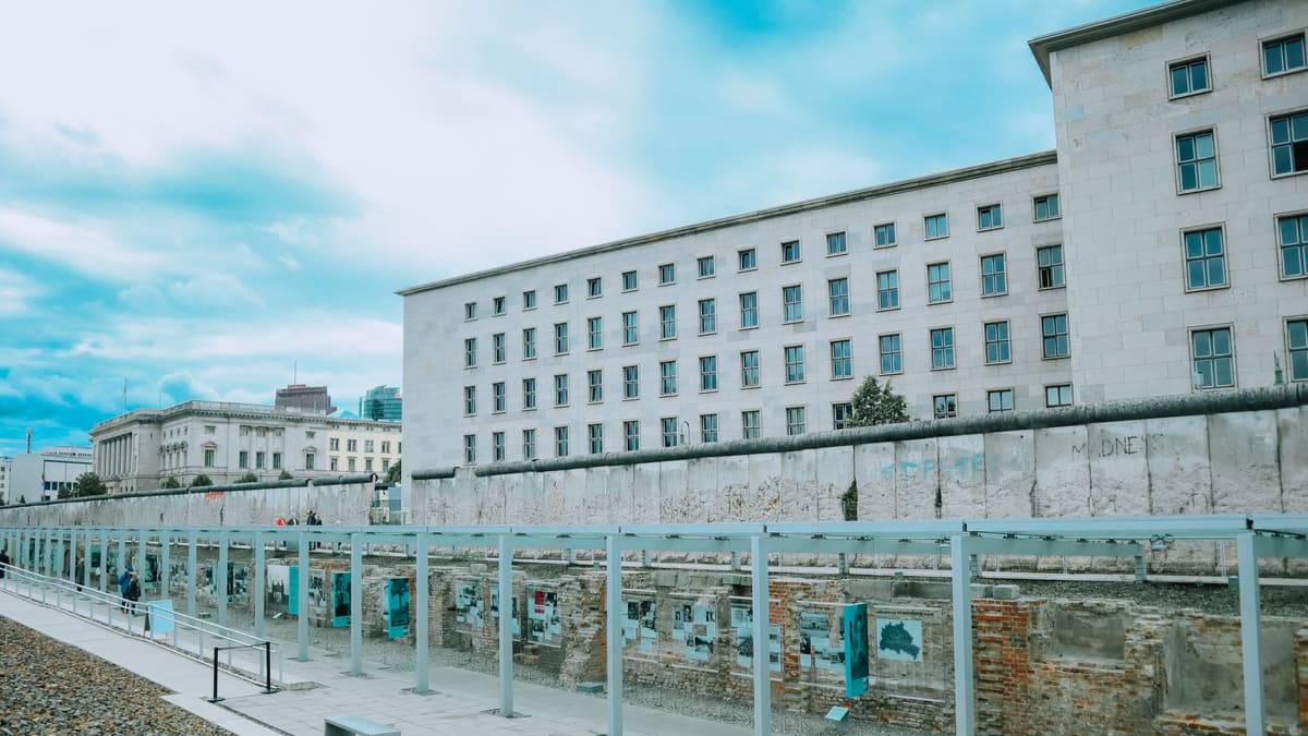 You're at the Topography of Terror. On the street side stands a piece of the later Berlin Wall, and on the site you'll see excavated cellar walls, lined with an outdoor exhibition.
Here stood the headquarters of the Gestapo, the SS and the Reich Security Main Office. The Gestapo kept its own prison here, the house prison.
As the Red Army closed in, most of the prisoners still held there were taken out and shot on a ruined site nearby. One detailed account puts the killings in the night of 23 to 24 April, on a ruined lot on Puttkamerstrasse. Even as the regime collapsed, it went on killing its prisoners.
A handful of prisoners survived in their cells and were freed by Red Army soldiers. The sources disagree on the details. One says six were freed on 28 April. Another says seven, on 2 May, after forty-four hours without food or water.
Now look across the street for the former Air Ministry. It was built in 1935 and 1936 as the Air Ministry for Hermann Göring. It was badly damaged in the war, but it stayed standing, and today it houses the Federal Finance Ministry.
Walk east to Wilhelmstrasse and turn left. Head north past the old Air Ministry, then follow your map left to the corner of Gertrud-Kolmar-Strasse and In den Ministergärten, about ten minutes. Look for an information board at the edge of a car park.
There is nothing to see here, and that is the point. You're looking at a car park and apartment blocks. At the corner stands an information board in German and English, put up by the Berliner Unterwelten association in 2006. Its stated aim is to counter myths and nostalgia.
Somewhere under this ground was the bunker where Hitler spent the end of the war. On 30 April 1945 he killed himself here. The board makes a plain point about what that meant for the city. While he lived, his officers were bound by their oath to him. His death released them from it, and opened the way to Berlin's surrender.
That night, General Hans Krebs crossed the front line to the Soviet commander, Vasily Chuikov. He announced Hitler's death and tried to win a separate ceasefire. It was refused. Krebs and Joseph Goebbels then took their own lives.
The end came two days later. On the morning of 2 May, General Helmuth Weidling, commander of the Berlin defense area, went to Chuikov's headquarters in Tempelhof, in the south of the city, and wrote out the order for the garrison to surrender. By that afternoon the surrender of the garrison was complete. The last scattered units in the city laid down their arms.
All through those final days, while the men in the bunker held on, thousands of Berliners waited in shelters like the one at Anhalter Bahnhof. Remember them here, not the bunker.
Walk west to Ebertstrasse and turn right. Head north to the Brandenburg Gate, about nine minutes in all.
포함 사항
저희 투어는 명상하듯 몰입할 수 있도록 만들어졌습니다. 걸으며 그저 귀 기울이시면 됩니다. 함께하면 언제나 더 좋고, 앱이 나레이션을 동기화해 재생하므로 당신과 파트너, 친구들이 모든 스톱을 같은 순간에 들을 수 있습니다.
Stand back far enough to see the top, where the Quadriga stands: a chariot drawn by four horses. What you see today is a restoration.
이 스톱의 나머지 내용은 전체 오디오 투어에 있습니다.
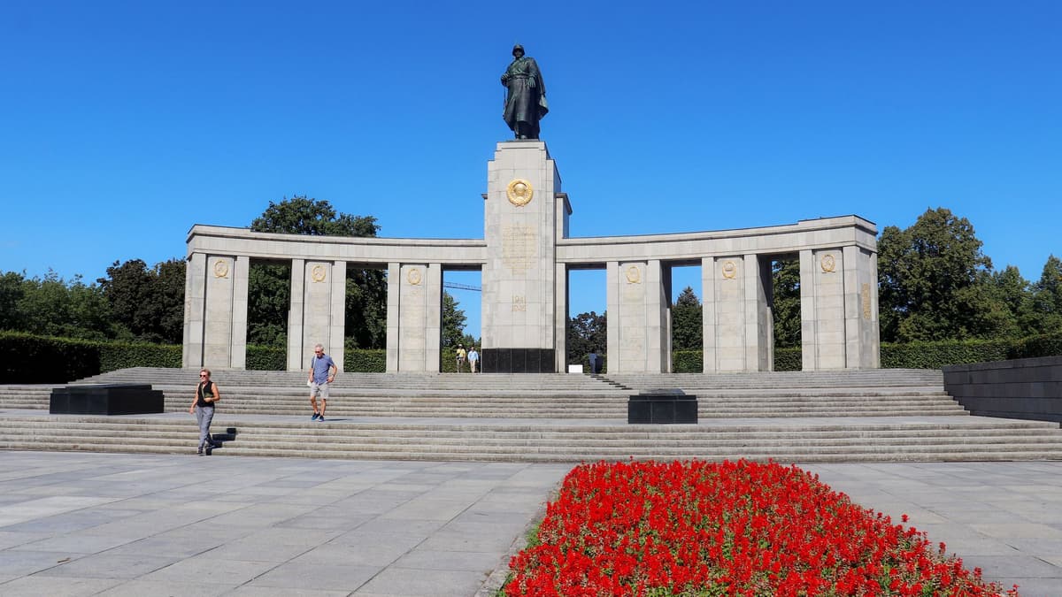
You're in front of the figure of a soldier on a column, about twenty meters high in all, the work of the sculptor Lev Kerbel. Around it are two sarcophagi, two guns and two T-34 tanks.
이 스톱의 나머지 내용은 전체 오디오 투어에 있습니다.
You're on the Moltke Bridge over the Spree. Look along the parapet for a shattered stone griffin, a mythical beast that is half eagle, half lion.
이 스톱의 나머지 내용은 전체 오디오 투어에 있습니다.
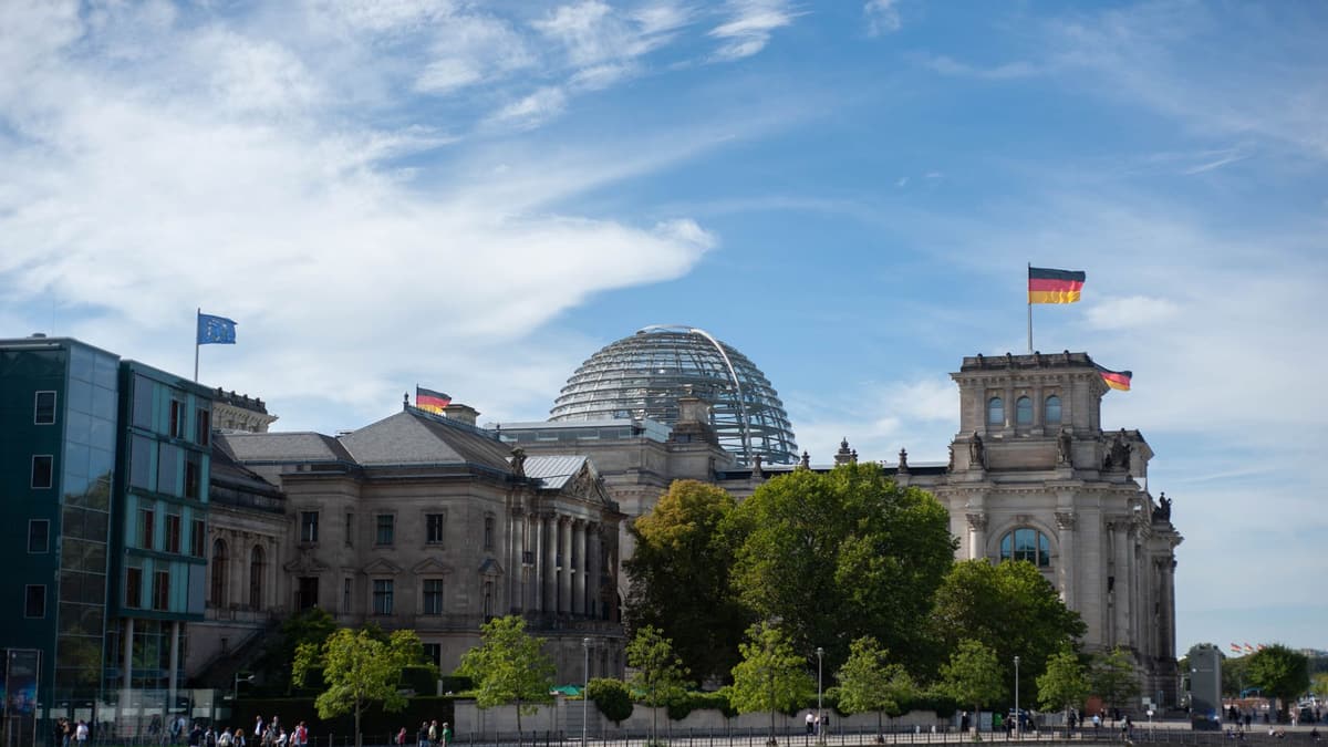
You're in front of the Reichstag, home of the German parliament, the Bundestag. On 30 April 1945 Red Army soldiers stormed it.
이 스톱의 나머지 내용은 전체 오디오 투어에 있습니다.
다음 예정된 투어에서 다른 사람들과 함께 이 산책을 해보세요.
약 5.1km, 여유로운 페이스로 대략 70분 소요 · 7 정류장
친구는 무료로 함께 걸어요October 11, 2026 · 9 min read
From the Hollandsche Schouwburg through the old Jewish Quarter, past the Dockworker and the Dam, to the Anne Frank House on the Prinsengracht.
October 11, 2026 · 11 min read
From Van Houten's street by the Vondelpark past Leidseplein, the Rijksmuseum passage and the famous canal bench to the Anne Frank House.
October 11, 2026 · 10 min read
Walk Bernauer Strasse from Ida Siekmann's window past Conrad Schumann's leap, Tunnel 57 and the Window of Remembrance to the Günter Litfin watchtower.