October 11, 2026 · 9 min read
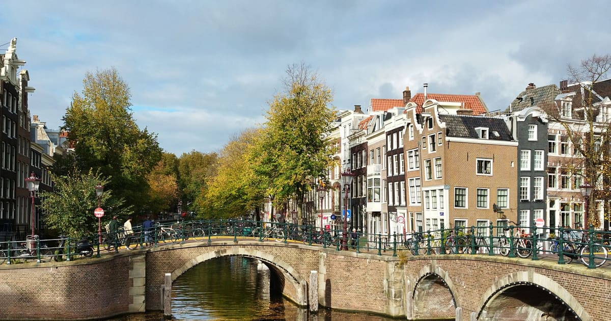
Amsterdam Anne Frank Walking Tour
From the Hollandsche Schouwburg through the old Jewish Quarter, past the Dockworker and the Dam, to the Anne Frank House on the Prinsengracht.
589
October 9, 2026 · 10 min read

 친구는 무료로 함께 걸어요
모든 투어는 앱에서 참여할 수 있는 정기 그룹 걷기 모임으로도 운영됩니다.
Yogyakarta의 오디오 투어 더 보기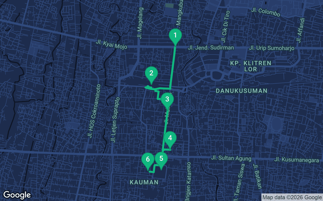
약 4.1km, 여유로운 페이스로 대략 57분 소요.
음성 가이드가 포함된 투어입니다
처음 3개 스톱에서 재생을 누르면 여기에서 나레이션을 30초 데모로 들을 수 있습니다. 앱에서는 인트로와 이 스톱들을 무료로 끝까지 들으실 수 있으며, 각 스톱에 도착하면 알림음이 울립니다. 전체 오디오 투어는 $9.99에 한 번만 구매하시면 평생 소장하실 수 있습니다.
Garmin, Komoot, Strava, OS Maps 및 모든 GPX 앱과 호환됩니다.
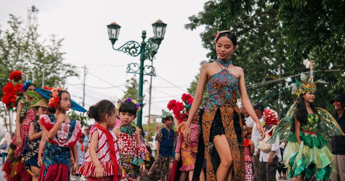
Yogyakarta, which almost everyone here simply calls Jogja, was laid out along one straight line, and this walk follows it south. It starts at the white Tugu monument at a busy crossroads, stops at the old railway station, then runs the length of Malioboro Street, the city's famous market road, past the Dutch fort and the presidential palace to the great north square in front of the Sultan's palace. It ends at the royal mosque in the old Kauman neighborhood. The route is about three kilometers, a little under two miles, and dead flat, which makes it one of the easiest self-guided walking tours in Java to fit into a cool morning.
The walking itself takes under an hour, but give it two to three hours with time for the fort museum, the stalls and a cold drink or two. The sidewalks are paved the whole way, and the long Malioboro walkway is wide and easy, but the crossings are busy with motorbikes. Cross with the locals, at a steady pace, and do not stop halfway. Jogja is hot and humid all year, and there is little shade on parts of this route, so start early, ideally soon after sunrise, when the light is soft and the city is waking up. Carry water and a hat. In the rainy months, afternoon downpours are common, so a morning start helps there too. Becak riders and the drivers of the horse-drawn andong will offer you rides all along Malioboro. A smile and a polite, firm "no, thank you" is all it takes, and if you do want a ride, agree on the price before you climb in. The fort museum's opening days and hours change, so check before you go. For the mosque at the end, wear something that covers your shoulders and knees, and be ready to take your shoes off.
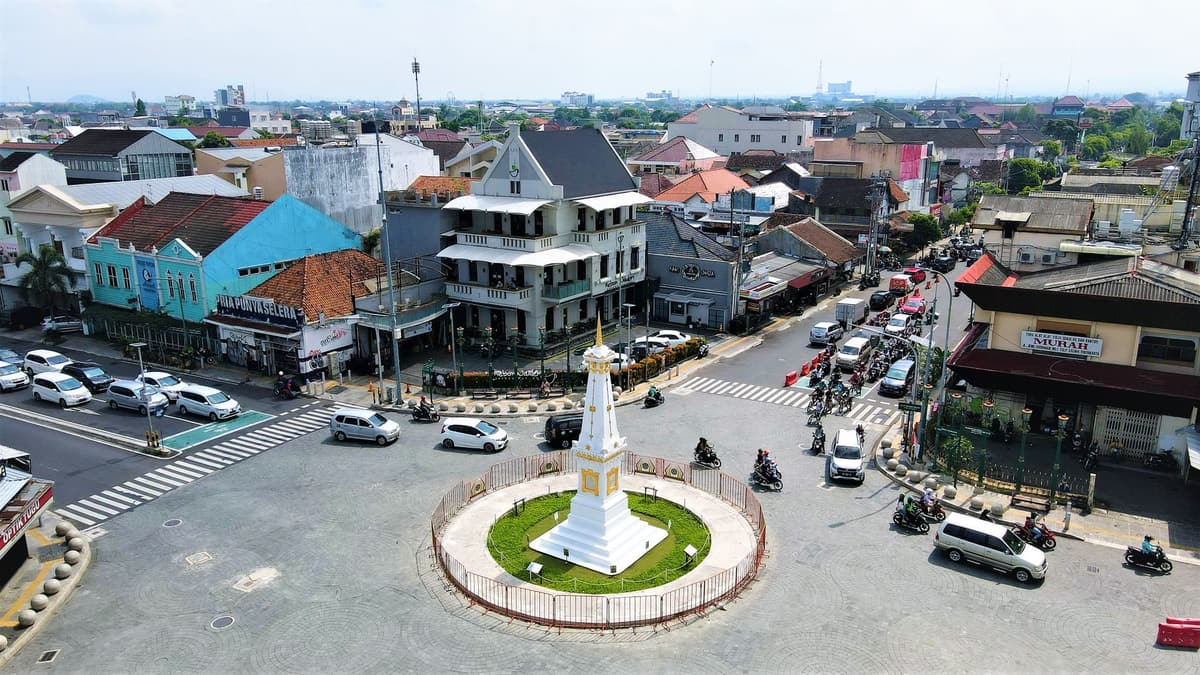
You are at one of the busiest crossroads in the city, so find a safe spot on one of the corners rather than stepping out into the traffic. In the middle stands Tugu, a white, tapering monument on a square base, crowned with a golden spiral. It looks modest, but it is the northern anchor of the whole city. When Sultan Hamengkubuwono I founded Yogyakarta in the 1750s, he raised a monument here as part of a deliberate plan. Picture a straight line running from Mount Merapi, the volcano to the north, through this spot, down the long street ahead of you to the Sultan's palace, and on to the Indian Ocean on the south coast. In Javanese thought the mountain and the sea stand for opposite forces, and the ruler sat between them, holding the balance. On a clear early morning you may glimpse Merapi's cone to the north. The original monument was a round column topped with a ball, often explained as a symbol of the unity of ruler and people. An earthquake brought it down in 1867, and the Dutch colonial government rebuilt it in 1889 in the shorter, square form you see now. In 2023 UNESCO listed this cosmological axis, with its landmarks, as a World Heritage Site. To move on, walk south down Jalan Margo Utomo, which some maps still call Jalan Mangkubumi, for about eight minutes to the railway crossing. Cross the tracks, turn right along Jalan Pasar Kembang beside the station, and walk a few more minutes to the old station building. About twelve to fifteen minutes in all.
 In front of you is Tugu Station, the city's main railway station, a long, low colonial building that opened in 1887, when the Dutch were linking the plantations and towns of central Java by rail. It is still very much a working station, with trains to Jakarta, Surabaya and the rest of the island, so expect crowds and porters and the sound of announcements. Its quiet place in history comes from one night early in the struggle for independence. In January 1946, with Jakarta occupied and unsafe, the leaders of the newly declared Republic of Indonesia, President Sukarno and Vice President Mohammad Hatta, were taken out of the capital in secret by train, and on the morning of 4 January they arrived here. Yogyakarta became the capital of the Republic, and it stayed at the center of the fight for independence for the next four years. You will meet that story again at the fort. The narrow lanes across the street, around Sosrowijayan, have long been the city's backpacker quarter, a maze of guesthouses, cheap cafes and laundries that is fun to wander later. When you are ready, walk back east along Jalan Pasar Kembang to the main road, turn right, and head south onto Malioboro. Keep going for about six or seven minutes, until the stalls thicken around you and a large walled government complex appears on your left. About ten minutes.
You are now on Malioboro, the street every visitor to Jogja ends up walking. Stand on the wide walkway and take in the scene: batik shirts and sarongs stacked high, leather shadow puppets, silver jewelry, boxes of bakpia, the sweet bean-filled pastries the city is known for, and lines of becak and andong waiting at the curb. The name is usually traced to an old Sanskrit word for garlands, because this was the processional road along the royal axis, decorated with flowers when the Sultan rode out. A popular story links it instead to the British Duke of Marlborough, from the few years when Britain ruled Java in the early nineteenth century, but most historians doubt it. The walled complex on the east side is the Kepatihan, once the residence and offices of the Sultan's chief minister and today the seat of the provincial government. Malioboro changes shape through the day. Mornings are calm, with shopkeepers sweeping and opening up. Evenings are when the street fills, with buskers playing, food stalls laying out mats on the pavement for lesehan dining, where you sit on the ground to eat, and the small angkringan carts serving tiny parcels of rice and sweet tea. In the market stalls, gentle bargaining is normal and friendly. Keep walking south for about ten minutes. You will pass Beringharjo, the city's big traditional market, on your left, a warren of batik and spices worth a detour, and the street becomes Jalan Margo Mulyo. The thick walls of the fort will appear on your left.
포함 사항
저희 투어는 명상하듯 몰입할 수 있도록 만들어졌습니다. 걸으며 그저 귀 기울이시면 됩니다. 함께하면 언제나 더 좋고, 앱이 나레이션을 동기화해 재생하므로 당신과 파트너, 친구들이 모든 스톱을 같은 순간에 들을 수 있습니다.
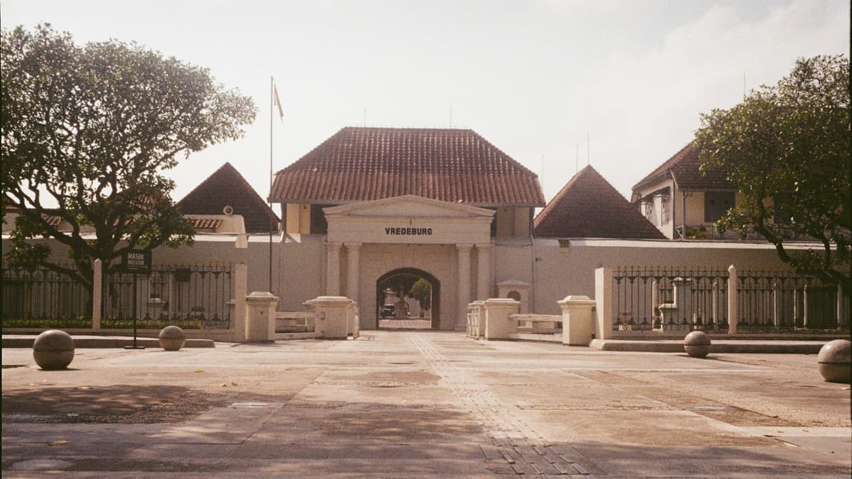
Stop where you can see the fort's low, whitewashed walls, its moat and its gate, and then turn around. Across the road stands Gedung Agung, a white colonial mansion with a columned porch.
이 스톱의 나머지 내용은 전체 오디오 투어에 있습니다.
You are on Alun-Alun Utara, the great north square in front of the Sultan's palace. Look south and you will see the first open pavilions of the Kraton at the far end.
이 스톱의 나머지 내용은 전체 오디오 투어에 있습니다.
Step through the gateway and you are in the courtyard of Masjid Gedhe Kauman, the Great Mosque of the Sultanate.
이 스톱의 나머지 내용은 전체 오디오 투어에 있습니다.
다음 예정된 투어에서 다른 사람들과 함께 이 산책을 해보세요.
약 4.1km, 여유로운 페이스로 대략 57분 소요 · 6 정류장
친구는 무료로 함께 걸어요October 11, 2026 · 9 min read
From the Hollandsche Schouwburg through the old Jewish Quarter, past the Dockworker and the Dam, to the Anne Frank House on the Prinsengracht.
October 11, 2026 · 11 min read
From Van Houten's street by the Vondelpark past Leidseplein, the Rijksmuseum passage and the famous canal bench to the Anne Frank House.
October 11, 2026 · 10 min read
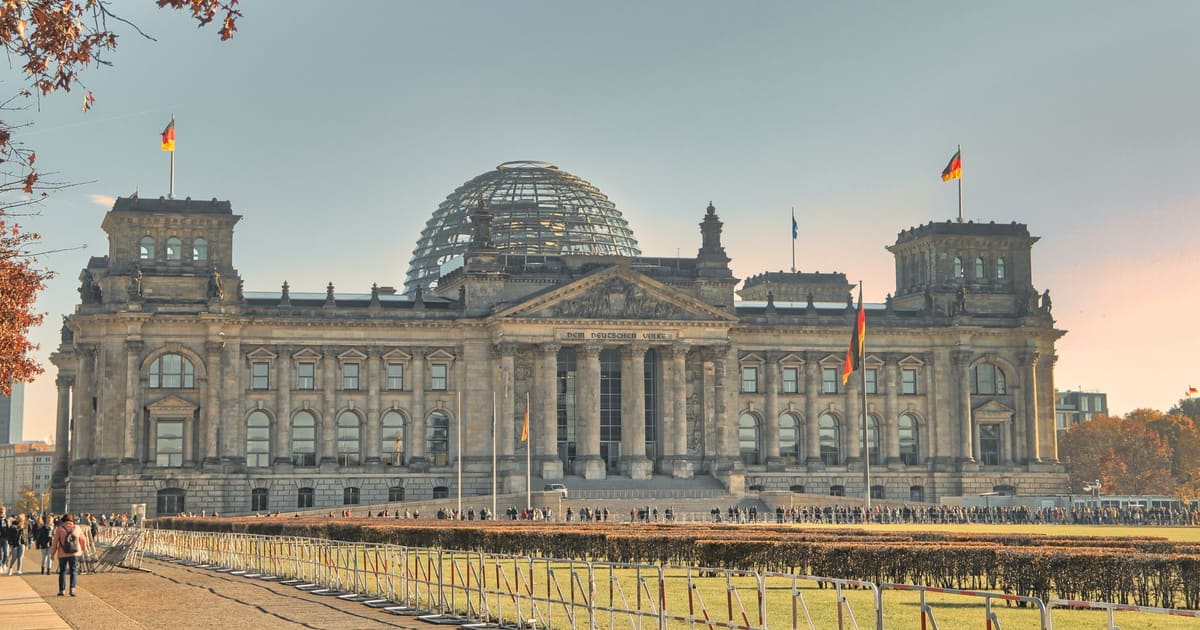
Follow the last days of April and May 1945 from the Anhalter Bahnhof ruin past the Gestapo site and Brandenburg Gate to the Moltke Bridge and the Reichstag.