October 11, 2026 · 9 min read
Amsterdam Anne Frank Walking Tour
From the Hollandsche Schouwburg through the old Jewish Quarter, past the Dockworker and the Dam, to the Anne Frank House on the Prinsengracht.
589
October 9, 2026 · 12 min read

 친구는 무료로 함께 걸어요
모든 투어는 앱에서 참여할 수 있는 정기 그룹 걷기 모임으로도 운영됩니다.
Tokyo의 오디오 투어 더 보기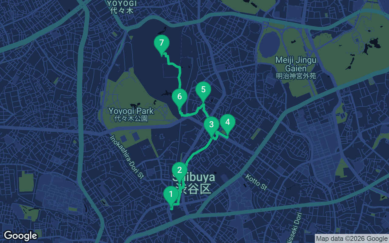
약 4km, 여유로운 페이스로 대략 57분 소요.
음성 가이드가 포함된 투어입니다
처음 3개 스톱에서 재생을 누르면 여기에서 나레이션을 30초 데모로 들을 수 있습니다. 앱에서는 인트로와 이 스톱들을 무료로 끝까지 들으실 수 있으며, 각 스톱에 도착하면 알림음이 울립니다. 전체 오디오 투어는 $9.99에 한 번만 구매하시면 평생 소장하실 수 있습니다.
Garmin, Komoot, Strava, OS Maps 및 모든 GPX 앱과 호환됩니다.
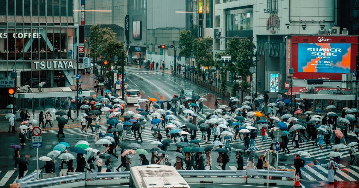
This is Tokyo turned up to full volume, and then switched off. The walk starts at the statue of a loyal dog beside the busiest pedestrian crossing on earth and heads north through some of the most fashionable streets in the city: a rooftop park over a shopping mall, a hidden lane laid over a buried river, the designer avenue of Omotesando and the teenage riot of Takeshita Street. Then you step under a wooden gate and into a forest, and the noise drops away so suddenly it feels like a trick. It finishes at Meiji Jingu, the shrine to the emperor who opened Japan to the modern world. It is about four kilometers, two and a half miles, more of a proper walk than a stroll, and among the most rewarding self-guided walking tours in Tokyo precisely because of that contrast.
Be honest with your legs about this one. The distance is around four kilometers, the walking alone takes about an hour, and with browsing, a crepe and time at the shrine you should allow three hours or more. It is gently uphill in places but never steep, and paved all the way except the wide gravel paths in the shrine forest, which are easy on the feet. Weekdays are calmer everywhere; on weekends Takeshita Street can be shoulder to shoulder, and Shibuya Crossing is wildest in the evening. A good plan is to start in the late morning, so that you reach the forest in the afternoon. Meiji Jingu's gates follow the sun, opening early and closing around dusk, so check before you go and do not leave the shrine too late in the day. Shibuya and Omotesando have little shade, and Tokyo summers are hot and sticky, so carry water; the forest at the end is the coolest place on the route. Bins are scarce, so keep a small bag for your rubbish. Carry a few coins if you would like to make an offering at the shrine.
Find the bronze dog sitting on his plinth in the little plaza outside the station's Hachiko exit, with the great crossing just beyond him. This is Hachiko, an Akita who belonged to Hidesaburo Ueno, a professor of agriculture at what is now the University of Tokyo. Through 1924 and into 1925, the young Hachi came to meet him off the train here. In May 1925 the professor died suddenly at work and never came home, and the dog went on coming to the station to wait for him, day after day, for almost ten years, until his own death in March 1935. A newspaper story made him famous, and a statue was unveiled here in 1934 with Hachiko himself in attendance. That first statue was melted down for metal during the war, and the one in front of you was cast in 1948 by the son of the original sculptor. Ko is an affectionate ending, so the name means something like dear little Hachi. Now turn to the crossing. When the lights stop the cars, every direction walks at once, diagonals included, and on a busy evening thousands of people cross in a single change of the lights without anyone bumping into anyone. Walk across it and back at least once; it is part of the tour. Then return to Hachiko, and with the station on your right, follow the tracks north, passing under the railway at the next road. The long low building of Miyashita Park runs alongside the tracks just ahead, about five minutes away.
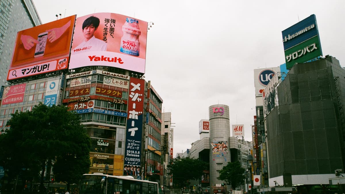
 In front of you is a building about three hundred meters long, laid out beside the tracks of the Yamanote Line, the green loop line that circles central Tokyo. From the street it looks like a sleek shopping mall with a hotel at one end, and it is, but climb the stairs or take the lift to the roof and you find a public park on top: lawns, benches, a skate park, a climbing wall and a sports court, with trains sliding past below. There has been a park on this strip of land since the 1950s, and for decades it was a park laid over a car park, one of the earliest rooftop parks in the city. The current version opened in 2020 after a complete rebuild. Its remakes have not been free of controversy, because the old park had been home to people sleeping rough, and they were moved out as it was redeveloped, something worth remembering as you admire the view. From the roof, look back toward the towers that have sprung up around Shibuya Station over the last decade, a skyline that has changed almost beyond recognition. Down at street level near the park's southern end, squeezed against the tracks, is Nonbei Yokocho, Drunkard's Alley, a postwar lane of tiny bars, some with room for only a handful of drinkers. Come down at the northern end of the park, cross Meiji-dori, and look for a narrow, car-free lane angling off to the northeast, away from the main road. That is Cat Street. Follow it north for about ten minutes to reach the next stop, close to where it meets Omotesando.
You have been walking on top of a river. Cat Street follows the course of the Onden River, a stream that once wound through the farming village of Onden here, and was covered over in the 1960s as Tokyo rebuilt itself around the 1964 Olympics. Notice how the lane bends and dips in the gentle way water does, and how buildings back onto it at odd angles, as if they once faced a riverbank. Two centuries ago this was countryside, and the great woodblock artist Katsushika Hokusai included a waterwheel at Onden in his series Thirty-six Views of Mount Fuji, with villagers at work beside the stream. Nobody seems quite sure where the name Cat Street came from. What is certain is what happened here in the 1990s. The backstreets around this lane became known as Ura-Harajuku, back Harajuku, and a handful of young designers opened tiny shops in them selling small runs of T-shirts and jackets that people queued around the block to buy. Labels such as A Bathing Ape and Undercover came out of that scene, and Ura-Harajuku helped shape the streetwear that later spread around the world. Today the lane mixes global sneaker stores, vintage shops and small cafes, and it is still one of the best places in Tokyo for people watching. Keep an eye out for bicycles, which share the lane. Walk north to the end of Cat Street, where it meets a broad avenue lined with trees, and turn right. Omotesando Hills is the long, low building on your left, about two minutes away.
포함 사항
저희 투어는 명상하듯 몰입할 수 있도록 만들어졌습니다. 걸으며 그저 귀 기울이시면 됩니다. 함께하면 언제나 더 좋고, 앱이 나레이션을 동기화해 재생하므로 당신과 파트너, 친구들이 모든 스톱을 같은 순간에 들을 수 있습니다.
You are on Omotesando, which means the front approach, because this avenue was laid out in the years around 1920 as the formal road to Meiji Jingu, the shrine at the end of this walk.
이 스톱의 나머지 내용은 전체 오디오 투어에 있습니다.
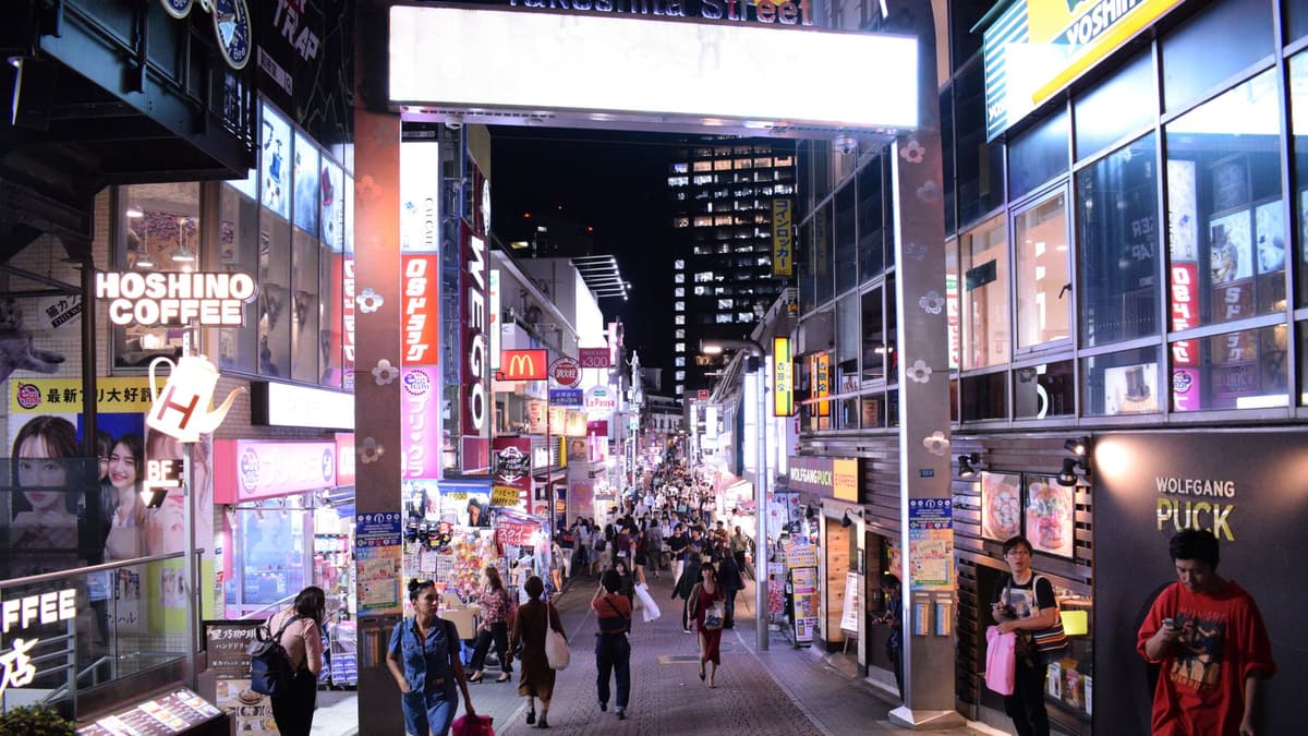
Look up the narrow street ahead, rising gently toward Harajuku Station and packed with shops, signs and people. Takeshita Street is about 350 meters long, and since the 1970s it has been the place where Tokyo teenagers come to look different.
이 스톱의 나머지 내용은 전체 오디오 투어에 있습니다.
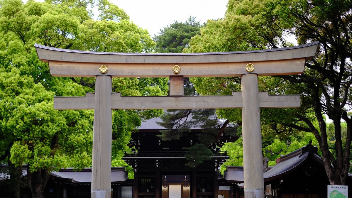
Stand in front of the tall wooden gate at the edge of the forest. This is a torii, the gate that marks the entrance to a Shinto shrine, the line between the everyday world and sacred ground.
이 스톱의 나머지 내용은 전체 오디오 투어에 있습니다.
You have reached the heart of the shrine, a wide courtyard of pale gravel enclosed by cypress buildings with green copper roofs.
이 스톱의 나머지 내용은 전체 오디오 투어에 있습니다.
다음 예정된 투어에서 다른 사람들과 함께 이 산책을 해보세요.
약 4km, 여유로운 페이스로 대략 57분 소요 · 7 정류장
친구는 무료로 함께 걸어요October 11, 2026 · 9 min read
From the Hollandsche Schouwburg through the old Jewish Quarter, past the Dockworker and the Dam, to the Anne Frank House on the Prinsengracht.
October 11, 2026 · 11 min read
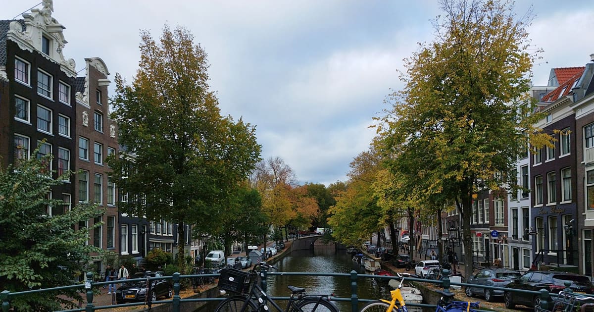
From Van Houten's street by the Vondelpark past Leidseplein, the Rijksmuseum passage and the famous canal bench to the Anne Frank House.
October 11, 2026 · 10 min read
Follow the last days of April and May 1945 from the Anhalter Bahnhof ruin past the Gestapo site and Brandenburg Gate to the Moltke Bridge and the Reichstag.