October 11, 2026 · 9 min read
Amsterdam Anne Frank Walking Tour
From the Hollandsche Schouwburg through the old Jewish Quarter, past the Dockworker and the Dam, to the Anne Frank House on the Prinsengracht.
589
October 9, 2026 · 11 min read

 Os amigos caminham grátis
Cada tour também funciona como uma caminhada em grupo agendada que você pode acessar no app.
Mais passeios de áudio em Galway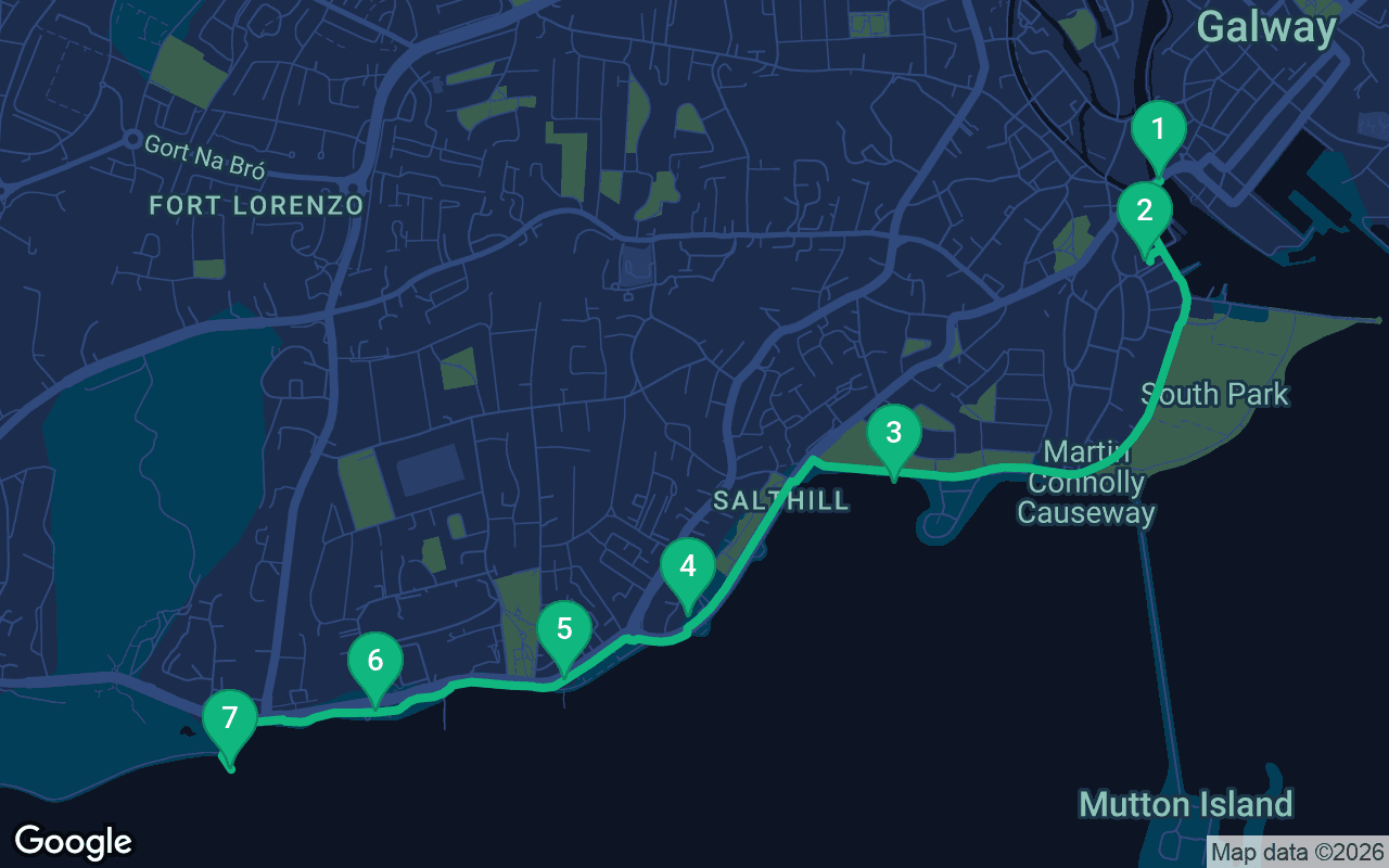
Cerca de 3,8 km, mais ou menos 51 minutos em passo tranquilo.
Este passeio é narrado
Aperte o play nas primeiras 3 paradas para ouvir uma demonstração de 30 segundos da narração. No aplicativo, a introdução e essas 3 paradas tocam completas e de graça, e cada uma avisa com um sinal sonoro quando você chega. Todo o passeio narrado é seu por $9.99, uma compra única que você guarda para sempre.
Funciona com Garmin, Komoot, Strava, OS Maps e qualquer app de GPX.
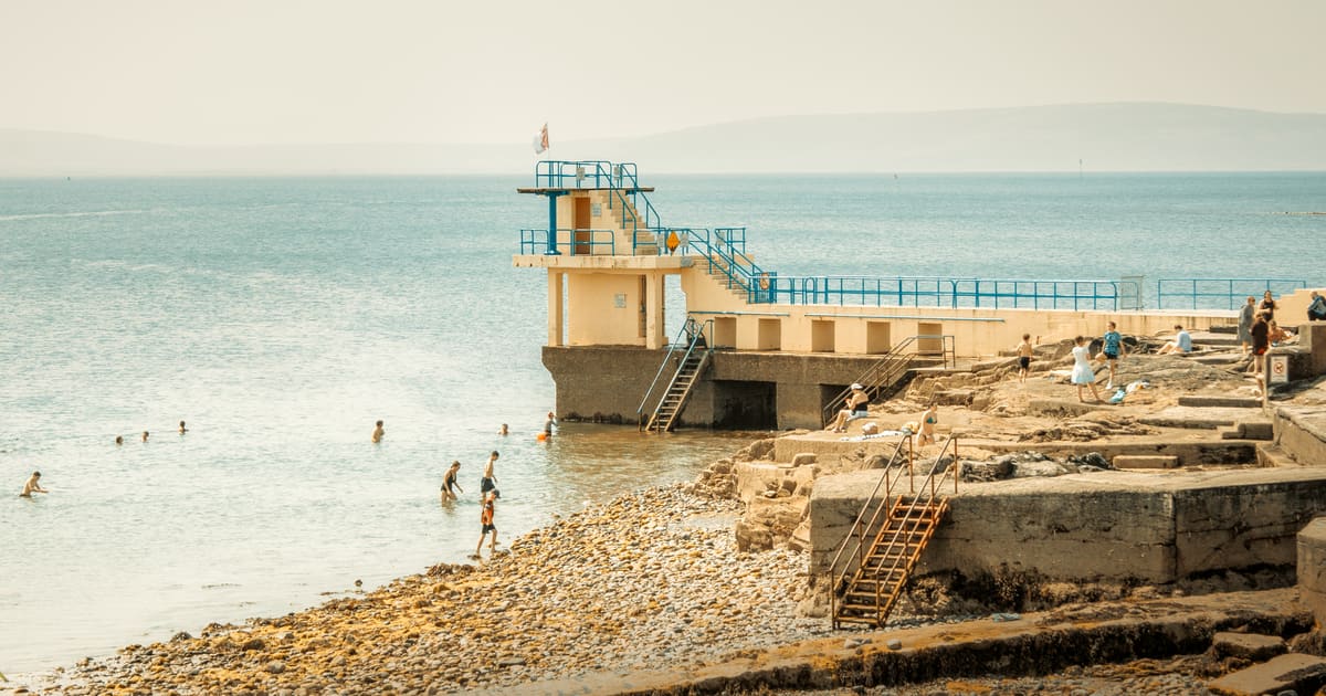
Ask anyone in Galway where they go for a walk and most will say the Prom. This route follows the city's favorite stroll from the mouth of the river out along the bay. It starts on Wolfe Tone Bridge, crosses into the Claddagh, the old fishing village on the west bank, and then follows the shore past Grattan Beach and the aquarium onto the long seafront promenade of Salthill. It ends at the Blackrock diving tower, where the custom is to kick the wall before you turn for home. The walk is about 3.8 kilometers, a little under two and a half miles, and flat the whole way, with the open bay on your left and the hills of the Burren across the water. It is one of the most relaxed self-guided walking tours in Ireland, and it pairs well with a morning in the old town, since that walk ends at the Spanish Arch, a few steps from where this one begins.
The walking takes a little under an hour, so allow an hour and a half to two hours with stops, and more if you go into the aquarium. The route is paved and level from start to finish, so it works well with a stroller or a wheelchair. The real thing to plan for is the weather. The prom faces straight out to the Atlantic, the wind can be strong even on a sunny day, and rain can arrive with very little warning. Bring a waterproof jacket with a hood, a warm layer and a hat, and leave the umbrella behind, because the wind will take it. In summer, wear sunscreen as well, since the breeze hides how strong the sun is. The best time to go is the evening, when the sun sets over the bay; in midsummer that is close to ten o'clock, and in winter it is late afternoon. The aquarium keeps its own hours and charges for entry, so check before you go. Lifeguards cover some of the beaches only in the summer season. When you finish, you can walk back the same way along the water, or catch a bus back into the city center.
Stand in the middle of Wolfe Tone Bridge and face downstream, toward the open water. Below you, the River Corrib makes its final rush into Galway Bay, fast and loud after rain, the whole of the great lake to the north emptying through this one channel. On your left, on the east bank, stands the old stone Spanish Arch and the row of painted houses known as the Long Walk. On your right is the Claddagh, where you are heading, and beyond it a long stone pier reaches out into the river mouth. That is Nimmo's Pier, named for Alexander Nimmo, a Scottish engineer who built harbors and piers along the west of Ireland in the early nineteenth century. The bridge is named after Theobald Wolfe Tone, a Dublin Protestant lawyer who helped found the Society of United Irishmen in 1791. Their aim was a republic independent of Britain that would unite Catholic, Protestant and Dissenter under the common name of Irishman. Tone went to France to ask for military help, and in 1798, the year of the rebellion, he was captured aboard a French warship off the coast of Donegal. He was sentenced to death and died of a wound in prison before the sentence could be carried out. Irish republicans of every stripe have claimed him since, which tells you something about how complicated his legacy is. Cross to the west bank and turn left along the water into the Claddagh, about two minutes.
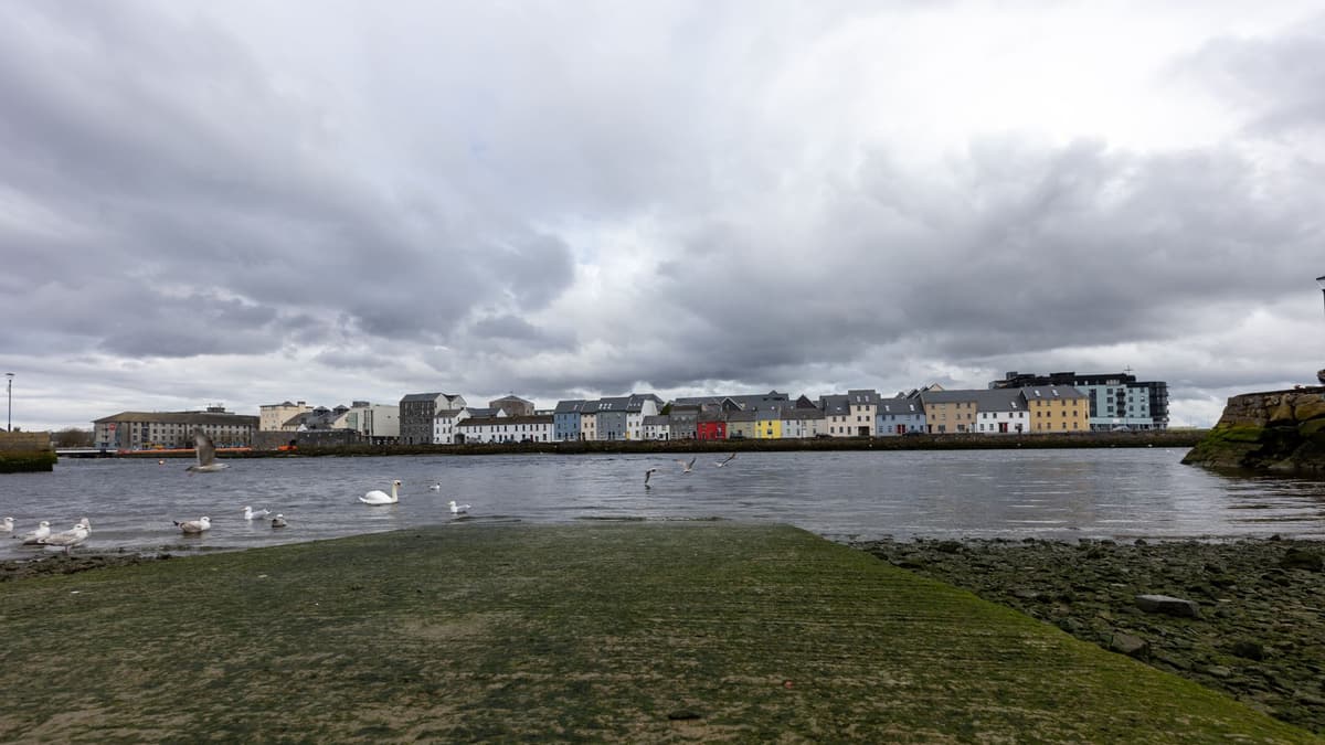 You are in the Claddagh, and the wide, calm stretch of water in front of you is the Claddagh Basin, usually crowded with swans. The name comes from the Irish An Cladach, the shore. For centuries this was a fishing village outside the town walls, Irish-speaking and fiercely independent, with its own customs and its own elected king, who settled disputes and led the fishing fleet. The title still survives as an honorary one. The village of thatched cottages was cleared in the 1930s, when the city replaced it with the council houses you see now, so little of the old Claddagh survives except its church and its sense of itself. The church is St Mary's on the Hill, run by the Dominicans, who have been at the Claddagh since the fifteenth century; the present building dates from the late 1800s. Look in the basin for the Galway hookers, the traditional sailing boats of this coast, with their black tarred hulls and rust-red sails. They carried turf from Connemara to the Aran Islands, which have no bogs, and fished the bay, and enthusiasts keep them sailing today. Then there is the ring: two hands holding a crowned heart, for friendship, love and loyalty. Tradition credits it to Richard Joyce, a Galway man said to have been captured at sea, enslaved in North Africa, and taught goldsmithing there before he came home late in the seventeenth century. Some early rings do carry his mark, but rings with joined hands are far older than Galway. Follow the shore southwest past the playing fields of South Park and onto Grattan Road, with the causeway to Mutton Island and its lighthouse on your left, about twelve minutes.
Grattan Beach is the sandy curve below the road, and it is the first place on this walk where you get the whole bay in front of you. Stand by the railing and look straight across the water. The low, grey, bare hills on the far shore are the Burren, in County Clare, a great plateau of limestone pavement, cracked into slabs, where plants from the Arctic and the Mediterranean grow side by side. On a clear day the stone seems almost white in the sun. On a wet one it disappears entirely, and you will understand why people here talk about the weather so much. This is a shallow, gentle beach, popular with families, and the tide makes a big difference here. At low water the sand stretches far out and rock pools appear at the edges, while at high tide the sea comes right up close. Watch for herons and oystercatchers working the waterline. Galway Bay has its own famous song, simply called Galway Bay, written by a Galway doctor, Arthur Colahan, and made famous around the world by Bing Crosby. It is sentimental, and locals have heard it more times than they would like, but stand here at sunset and you can see where it came from. Keep following Grattan Road west along the seafront, and the aquarium is the building on the seaward side where the promenade begins, about eight minutes.
O que está incluído
Nossos passeios foram feitos para ser meditativos e imersivos: você caminha e simplesmente escuta. Eles são sempre melhores em companhia, e o aplicativo toca a narração sincronizada, para que você, seu par e seus amigos ouçam cada parada ao mesmo tempo.
Galway Atlantaquaria is the National Aquarium of Ireland, and the low building in front of you focuses almost entirely on the life of Irish waters, from rivers and lakes out to the deep Atlantic.
O restante desta parada está no passeio em áudio completo.
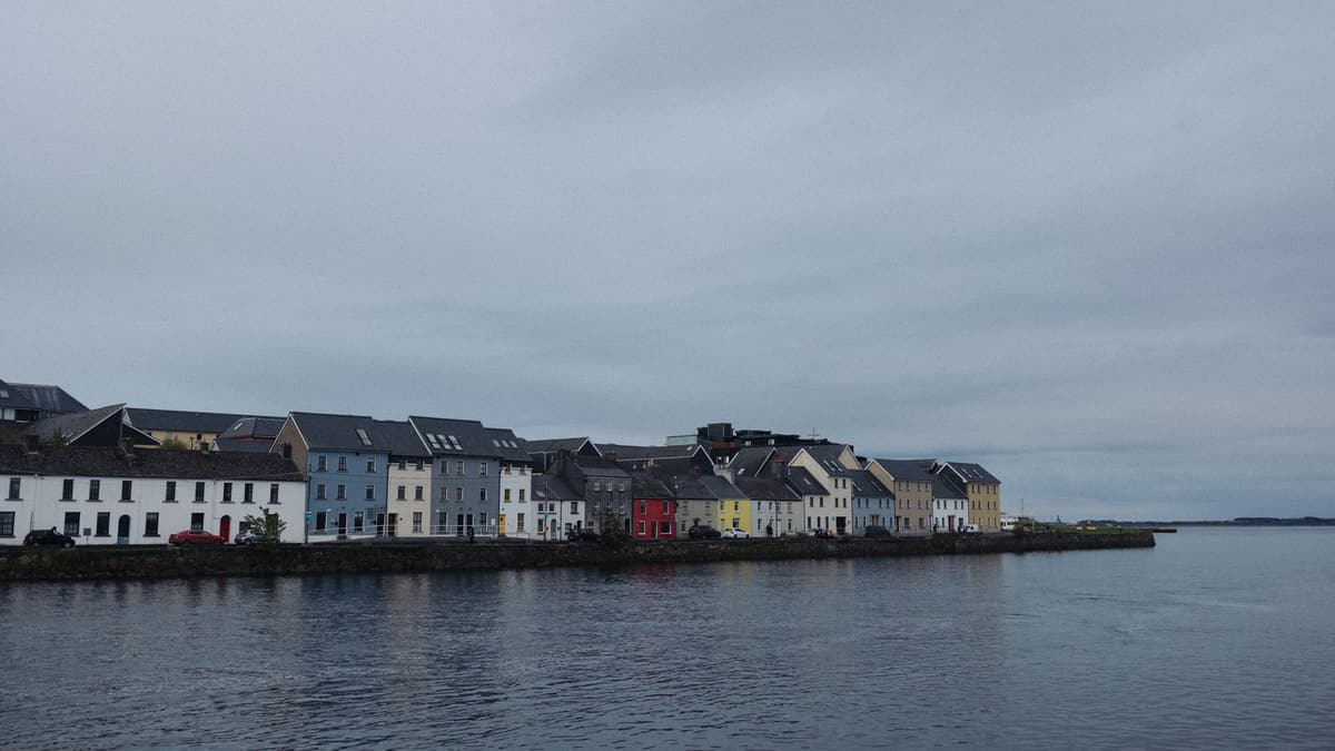
This is the Prom, the Salthill Promenade, a broad walkway that runs for a couple of kilometers along the seafront, and it is where Galway comes to walk, run, swim and talk. In Irish, Salthill is Bóthar na Trá, the road of the beach.
O restante desta parada está no passeio em áudio completo.
Ladies Beach is the small sheltered cove below you, a pocket of sand tucked in between rocky outcrops, calmer than the open beaches farther east. Its name is a leftover from an age when men and women did not bathe together.
O restante desta parada está no passeio em áudio completo.
You have reached the Blackrock Diving Tower, the tall concrete platform standing above the sea at the western end of the prom. For most of its history Blackrock was a bathing place for men only, the counterpart of Ladies Beach.
O restante desta parada está no passeio em áudio completo.
Faça esta caminhada com outras pessoas no próximo passeio agendado.
Cerca de 3,8 km, aproximadamente 51 minutos em ritmo leve · 7 paradas
Os amigos caminham grátisOctober 11, 2026 · 9 min read
From the Hollandsche Schouwburg through the old Jewish Quarter, past the Dockworker and the Dam, to the Anne Frank House on the Prinsengracht.
October 11, 2026 · 11 min read
From Van Houten's street by the Vondelpark past Leidseplein, the Rijksmuseum passage and the famous canal bench to the Anne Frank House.
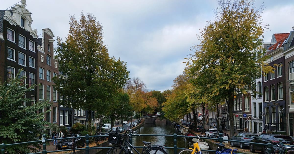
October 11, 2026 · 10 min read
Follow the last days of April and May 1945 from the Anhalter Bahnhof ruin past the Gestapo site and Brandenburg Gate to the Moltke Bridge and the Reichstag.