October 11, 2026 · 9 min read
Amsterdam Anne Frank Walking Tour
From the Hollandsche Schouwburg through the old Jewish Quarter, past the Dockworker and the Dam, to the Anne Frank House on the Prinsengracht.
589
October 9, 2026 · 10 min read

 Bạn bè đi bộ miễn phí
Mỗi tour cũng được tổ chức như một chuyến đi bộ nhóm theo lịch trình mà bạn có thể tham gia trong ứng dụng.
Thêm tour âm thanh tại Auckland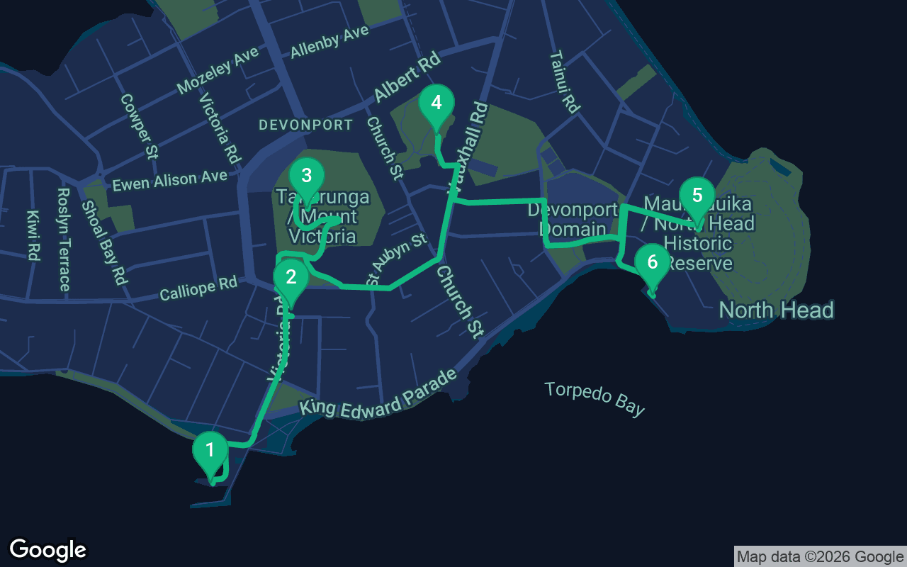
Khoảng 4,3km, mất khoảng 64 phút với nhịp độ thoải mái.
Tour này có thuyết minh âm thanh
Nhấn phát tại 3 điểm dừng đầu tiên để nghe thử 30 giây phần thuyết minh ngay tại đây. Trong ứng dụng, phần giới thiệu và các điểm dừng này được nghe trọn vẹn miễn phí, và mỗi điểm dừng sẽ phát âm báo khi bạn đến nơi. Toàn bộ chuyến tham quan có thuyết minh sẽ là của bạn chỉ với $10.99, mua một lần và sở hữu mãi mãi.
Hoạt động với Garmin, Komoot, Strava, OS Maps và mọi ứng dụng GPX.
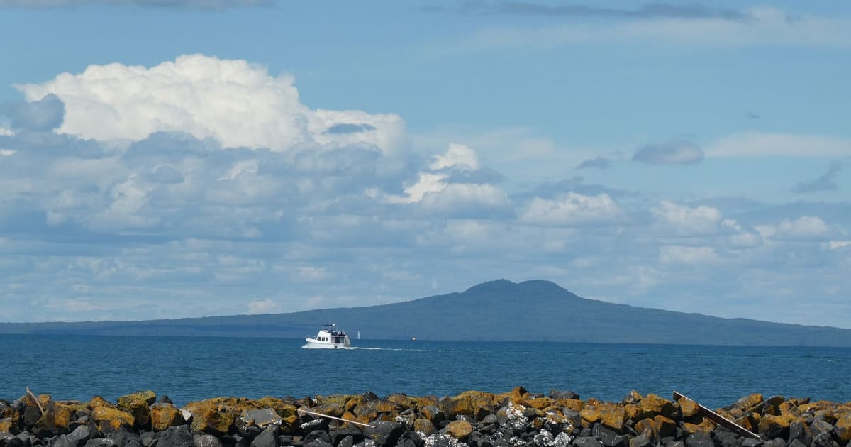
Devonport feels like a seaside village that somehow ended up a short boat ride from New Zealand's biggest city. It sits on a peninsula across the Waitematā Harbour from downtown Auckland, a place of Victorian villas, old shopfronts and pōhutukawa trees, with two small volcanoes rising behind it. This walk starts at the ferry wharf, climbs Mount Victoria for the finest view of the city, calls in at a volunteer museum in an old church, then climbs North Head, a volcano hollowed out with tunnels and gun pits, and finishes on the shore of Torpedo Bay at the museum of the navy. It is about four kilometers, roughly two and a half miles, with two short, honest climbs, and it is one of the most satisfying self-guided walking tours you can make from Auckland in a single morning or afternoon.
Catch the Devonport ferry from the Ferry Building on Quay Street in the city. The crossing takes little more than ten minutes, and ferries run often through the day, but check the timetable for your return. Allow two and a half to three hours for the walk itself, and more if you linger in the two museums. There are two climbs. Mount Victoria is a steady uphill walk of ten minutes or so on a road and grassy paths, and North Head is a little lower and gentler. Both summits are exposed, so bring a windproof layer even on a warm day, plus a hat, sunscreen and water, since Auckland's weather can swing from sun to showers and back within the hour. Wear shoes with some grip, because the grass on the slopes gets slippery after rain. If you want to explore the tunnels on North Head, carry a small torch or use your phone's light. The Devonport Museum is run by volunteers and opens only on certain days, and the Navy Museum is free for New Zealand residents but charges visitors from overseas, so check both before you go. The village has cafes, bakeries and an ice cream shop or two, for the end.
Step off the ferry and turn around before you do anything else. The whole of downtown Auckland is laid out across the water behind you, with the Sky Tower rising from the middle of it and the Harbour Bridge off to the west. People have been making this crossing for a long time. Small sailing cutters carried passengers between Devonport and the foot of Queen Street from the 1840s, paddle steamers took over around 1860, and the steam ferry company founded in 1881 turned a scattered settlement into a commuter suburb. Until the Harbour Bridge opened in 1959, ferries, including vehicle ferries, were the main link between the city and the whole North Shore. The village grew up along Victoria Road, the main street that runs inland from the wharf, prompted by the ferry service and the wharf and hotel built at its foot in the 1860s. The settlement was first known as Flagstaff, after a signal mast on the hill ahead, and later took the name of the English naval town of Devonport. The name fits. The Royal New Zealand Navy's main base lies just west of here along the shore, and you may spot grey ships moored there. With your back to the water, cross to the head of Victoria Road and walk north up it, past the shops and cafes, to the old cinema on the street, about seven minutes.
 The Vic, more formally the Victoria Theatre, is the brick building on Victoria Road with the classic cinema front, and it has a claim that few small towns can match. It opened on 26 October 1912 as a purpose-built picture theatre, and it is generally described as the oldest surviving purpose-built cinema in New Zealand, and in the whole Southern Hemisphere. In 1912 moving pictures were still a novelty, shown with live music, and a dedicated building for them was a bold bet. The theatre was remodeled in 1929, which is when it took on the stripped classical look and the touches of Art Deco you can still see. Inside, early on, it was one of the first cinemas in the country to have a shallow stage at the front, so it could mix films with live acts. Like many old picture houses, it went through lean years, and in the end a local trust bought and restored it, and it reopened on its birthday in 2010, showing films and hosting live shows. Have a look at the posters, and if you are staying over, an evening film here is a lovely way to end a Devonport day. From here, continue a short way north along Victoria Road and follow the signs to the summit road, which winds up the slope above you, or take the steeper grassy paths straight up, about ten minutes of steady climbing.
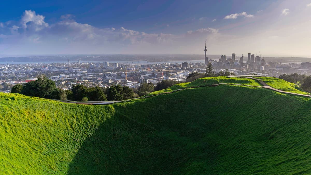
You are standing on top of Takarunga, also called Mount Victoria, the highest volcano on Auckland's North Shore and one of the roughly fifty volcanoes that make up the Auckland volcanic field. Take a slow turn on the summit. To the northeast, Rangitoto rises from the gulf, the youngest volcano in the field, born from the sea only about six hundred years ago. To the south is the city, close enough to pick out individual buildings. The name Takarunga means the hill standing above, and it was given in contrast to its smaller neighbor, Takararo, which you will meet next. Look at the slopes below you and you can still see the terraces and storage pits of a pā, a fortified village. In the eighteenth century the Waiohua paramount chief Kiwi Tāmaki came here seasonally to catch and preserve birds. In 1841 a signal station was set up on the peak to report ships to the port, which gave the settlement below its first name, Flagstaff. In 1885, during a war scare you will hear more about on North Head, a gun fort was built on the summit, and one of its heavy disappearing guns is still on show. The brightly painted mushrooms poking out of the grass are vents for a water pumping station inside the mountain. Since a Treaty of Waitangi settlement in 2014, Takarunga has belonged to a collective of thirteen Auckland iwi and hapū, and it is cared for by the Tūpuna Maunga Authority. Walk back down the summit road and follow the paths down the mountain's eastern side to Vauxhall Road, where the museum sits in a green reserve, about fifteen minutes.
Bao gồm những gì
Các tour của chúng tôi được thiết kế để mang tính thiền định và đắm chìm: bạn vừa đi vừa lắng nghe. Đi cùng nhau luôn tuyệt hơn, và ứng dụng phát thuyết minh đồng bộ để bạn, người thương và bạn bè nghe mỗi điểm dừng cùng một lúc.
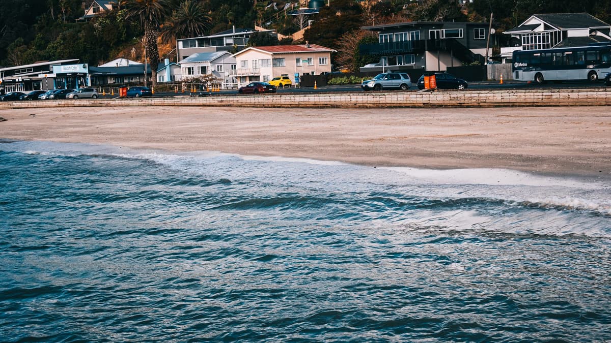
The Devonport Museum is the small wooden church set in a garden at the foot of a low, grassy rise. That rise is all that is left of Takararo, or Mount Cambria, the hill standing below.
Phần còn lại của điểm dừng này có trong tour âm thanh đầy đủ.
North Head is Maungauika, the mountain of Uika, named after an ancestor said to have lived here some eight hundred years ago.
Phần còn lại của điểm dừng này có trong tour âm thanh đầy đủ.
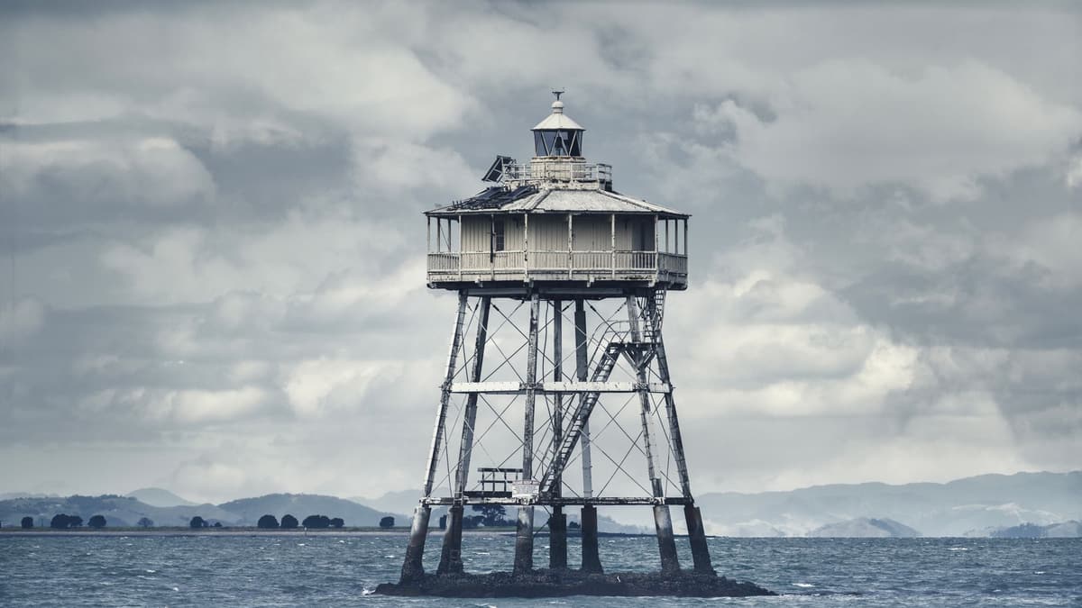
Your walk ends at the Torpedo Bay Navy Museum, the National Museum of the Royal New Zealand Navy, set right on the beach. The bay is named after its torpedo yard, from a time when the word torpedo meant a naval mine.
Phần còn lại của điểm dừng này có trong tour âm thanh đầy đủ.
Thực hiện buổi đi bộ này cùng người khác vào tour đã lên lịch tiếp theo.
Khoảng 4,3km, mất khoảng 64 phút với nhịp độ thoải mái · 6 điểm dừng
Bạn bè đi bộ miễn phíOctober 11, 2026 · 9 min read
From the Hollandsche Schouwburg through the old Jewish Quarter, past the Dockworker and the Dam, to the Anne Frank House on the Prinsengracht.
October 11, 2026 · 11 min read
From Van Houten's street by the Vondelpark past Leidseplein, the Rijksmuseum passage and the famous canal bench to the Anne Frank House.
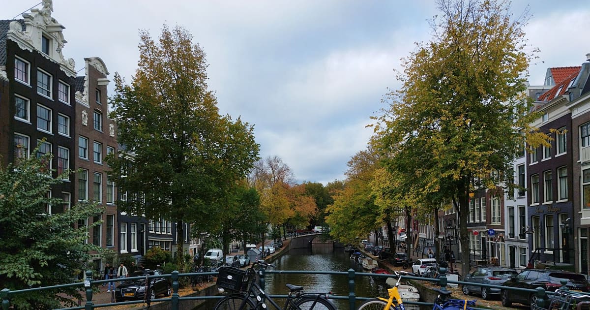
October 11, 2026 · 10 min read
Follow the last days of April and May 1945 from the Anhalter Bahnhof ruin past the Gestapo site and Brandenburg Gate to the Moltke Bridge and the Reichstag.