October 11, 2026 · 9 min read
Amsterdam Anne Frank Walking Tour
From the Hollandsche Schouwburg through the old Jewish Quarter, past the Dockworker and the Dam, to the Anne Frank House on the Prinsengracht.
589
October 9, 2026 · 9 min read

 Friends walk free
Every tour also runs as a scheduled group walk you can join in the app.
More audio tours in Antalya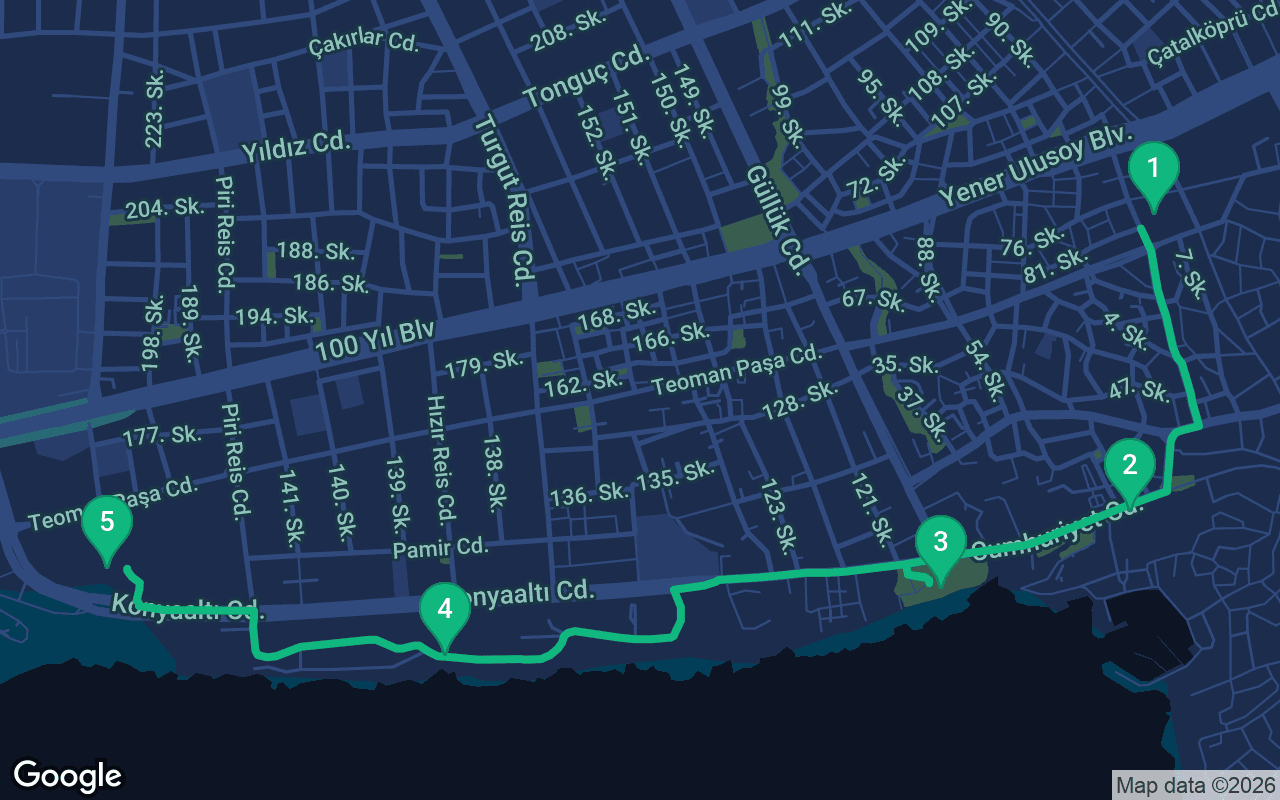
About 3 km, roughly 42 minutes at an easy pace.
This tour is narrated
Press play on the first 3 stops for a 30-second demo of the narration. In the app, the intro and those 3 stops play in full for free, each one chiming as you arrive. The whole narrated tour is yours for $8.99, a one-time purchase you keep for good.
Works with Garmin, Komoot, Strava, OS Maps and any GPX app.
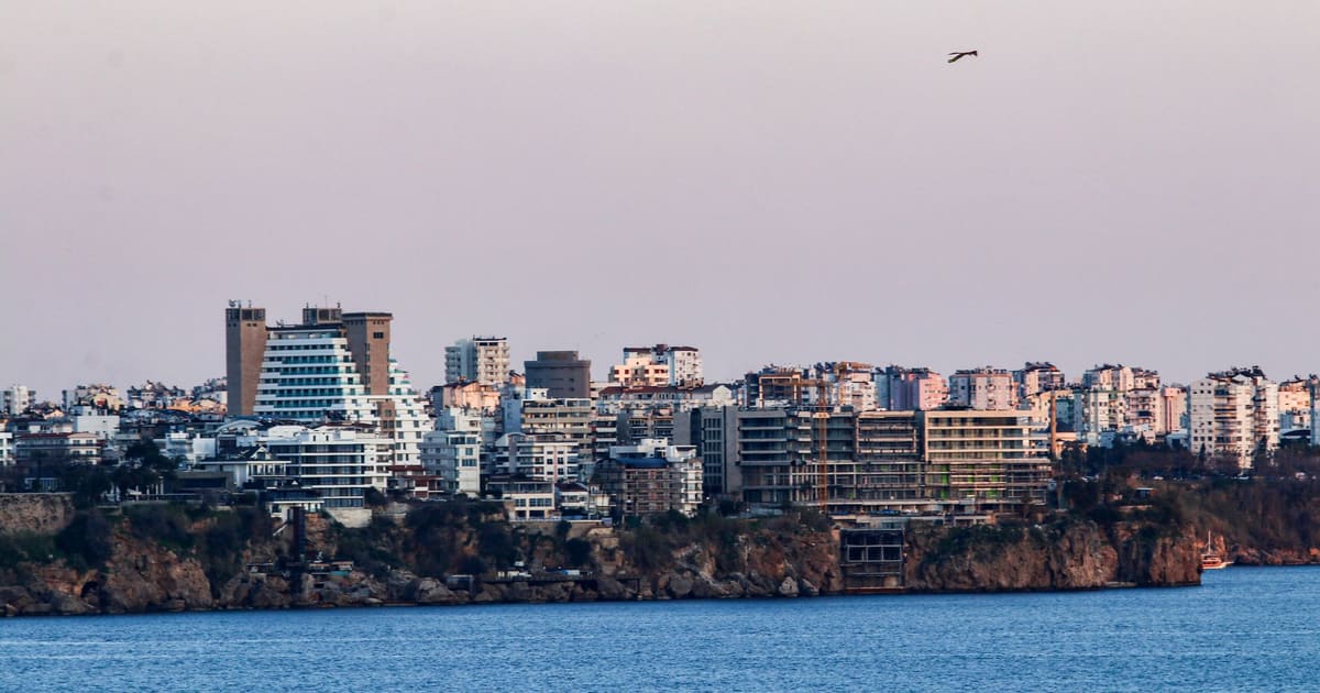
Antalya is built on top of a cliff, and the best way to understand that is to walk along the edge of it. This route starts at a sixteenth-century Ottoman mosque in the middle of town, heads down past Republic Square to the sea, then follows a chain of clifftop parks west above the Mediterranean, with the Taurus Mountains rising across the bay the whole way. It finishes at the Antalya Museum, home to some of the finest Roman statues in Türkiye. It is about 3 kilometers, just under two miles, flat from start to finish, and one of the easiest and most beautiful self-guided walking tours in the city, with tea gardens and sea breezes along every stretch.
Allow about an hour for the walk itself at an easy pace, plus at least two hours for the museum, which deserves them. The route is flat and paved, on wide pavements and park paths, so it suits almost anyone, and the nostalgic tram runs along the main road beside you if your legs give out, with its last stop right at the museum. The big thing to plan around is the heat. From June to September Antalya regularly passes 35°C (95°F), and these clifftop parks face south over the water with only patchy shade from palms and pines. In summer, walk first thing in the morning and spend the hot middle of the day inside the museum, or start in the late afternoon and save the museum for another day, since the sunset over the mountains from the cliffs is the finest thing on this walk. Carry water, wear a hat and sunscreen, and stop at the tea gardens along the way. Spring, autumn and winter are far gentler, and the mountains are often capped with snow in the cooler months. The Murat Paşa Mosque is a working mosque, so dress modestly. The museum's hours and closing days change, so check before you go.
You start at the Murat Paşa Mosque, a classic Ottoman mosque standing in a walled courtyard among the busy streets of the modern city. Step into the courtyard and look at the building: a single broad dome, a porch of arches in front, and a slender minaret beside it. It was built around 1570 by an Ottoman official named Murat Paşa, in the century when the empire was at the height of its power, and it was important enough that the whole surrounding area took his name. Muratpaşa is now one of Antalya's main districts, home to the old town and much of the city center, so you will see the name on signs and buses everywhere. The mosque is admired for its decoration, especially its tilework and the painted designs inside, done in the style that Ottoman craftsmen spread across the empire. The courtyard is a calm spot after the traffic outside, a small pocket of the old city where people still come and go for prayer five times a day, as they have for more than four centuries. If you go inside, cover your shoulders and knees, take your shoes off at the door, women cover their hair, and avoid the times of prayer, especially Friday at midday. Walk quietly and do not photograph people praying. When you leave, head south, downhill toward the sea, for about eight minutes. You will reach Cumhuriyet Caddesi at Republic Square, and Tophane Park sits right beside the square on the cliff edge.
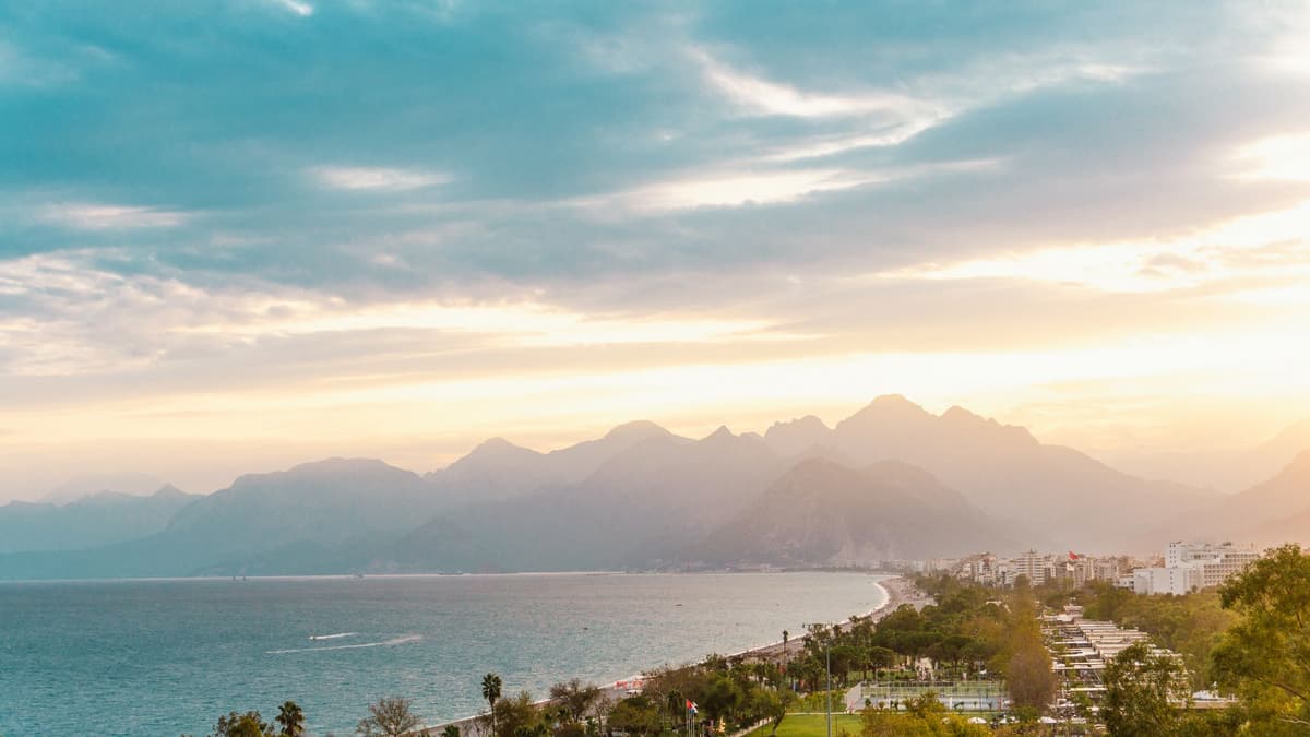 You have reached Tophane Park, a strip of tea gardens and terraces perched above the sea, right beside Republic Square with its large monument to Atatürk. The name recalls the cannons the Ottomans once kept up here to guard the harbor, and you can see why: walk to the edge and the whole bay lies at your feet. Directly below is the old harbor, curled inside the walls of Kaleiçi, the walled old town, which has its own walk. Now lift your eyes across the water. That great wall of mountains running down the far side of the bay is the Beydağları range, part of the Taurus Mountains, which sweep along the whole southern coast of Türkiye. They rise straight up from the sea to well over 2,000 meters, and the tallest peak you can pick out to the south-west on a clear day is Tahtalı, which the ancient Lycians knew as Mount Olympos. Snow often clings to the summits into spring, when you can be sitting in warm sunshine down here. Locals come to this park for exactly that view and a glass of tea, and you should do the same: order a çay, which comes strong, sweet if you like, in a small tulip-shaped glass. From here, walk west along Cumhuriyet Caddesi, keeping the sea on your left, for about five minutes to Yavuz Özcan Park.
Yavuz Özcan Park is a small, quiet patch of green, little more than a row of benches and trees right on the brink of the cliff, and it gives you the most direct view of the sea on the walk. Stand at the railing and look down at the rock beneath you. It is not ordinary stone. Antalya is built on travertine, a pale, porous rock made by mineral-rich water. For many thousands of years, water flowing down from the Taurus Mountains carried dissolved limestone with it, and as it spread out across this coastal plain it left that lime behind, layer upon layer, until it built up a great shelf of rock. Where that shelf meets the sea, the waves have cut it into these sheer cliffs. Look closely at the cliff face and you can see the holes and pockets that give travertine its spongy look. The same water still flows under and through the city. East of the center, the Düden River tumbles straight off the cliffs into the sea in a waterfall, a sight best seen from a boat. Water is the secret of Antalya's gardens and orchards too: it is why the plain around the city has been famous for its oranges and other fruit for centuries. Carry on west along the main road, which becomes Konyaaltı Caddesi as it heads toward the beach, with the sea on your left, for about thirteen minutes to the long green belt of Atatürk Park.
What's included
Our tours are made to be meditative and immersive: you keep moving and simply listen. They're always better together, and the app plays the narration in sync, so you, your partner and your friends hear every stop at the same moment.
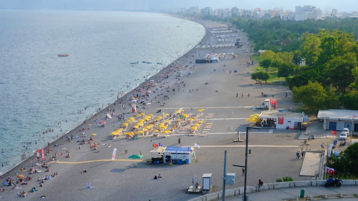
Atatürk Park is the city's great clifftop promenade, a long belt of lawns, palms and tea gardens stretched along the edge of the cliff. This is where Antalya comes to watch the sun go down.
The rest of this stop is in the full audio tour.
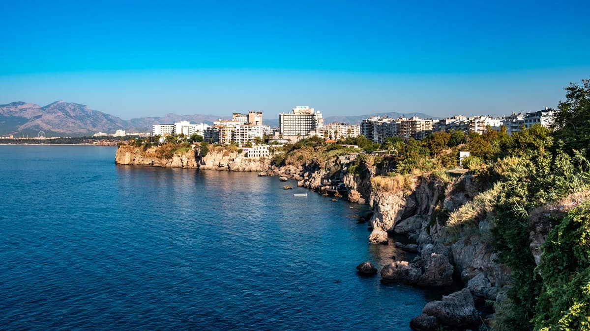
The walk ends at the Antalya Museum, one of the best archaeology museums in Türkiye, and the reward for all those sea views.
The rest of this stop is in the full audio tour.
Do this walk with other people on the next scheduled tour.
About 3 km, roughly 42 minutes at an easy pace · 5 stops
Friends walk freeOctober 11, 2026 · 9 min read
From the Hollandsche Schouwburg through the old Jewish Quarter, past the Dockworker and the Dam, to the Anne Frank House on the Prinsengracht.
October 11, 2026 · 11 min read
From Van Houten's street by the Vondelpark past Leidseplein, the Rijksmuseum passage and the famous canal bench to the Anne Frank House.
October 11, 2026 · 10 min read
Follow the last days of April and May 1945 from the Anhalter Bahnhof ruin past the Gestapo site and Brandenburg Gate to the Moltke Bridge and the Reichstag.