
 $15.99Turning Points
San Francisco Waterfront Walk: Ferry Building to Fort Mason
Choose how you'll do this walk in our app

 Friends walk free
Every tour also runs as a scheduled group walk you can join in the app.
More audio tours in San Francisco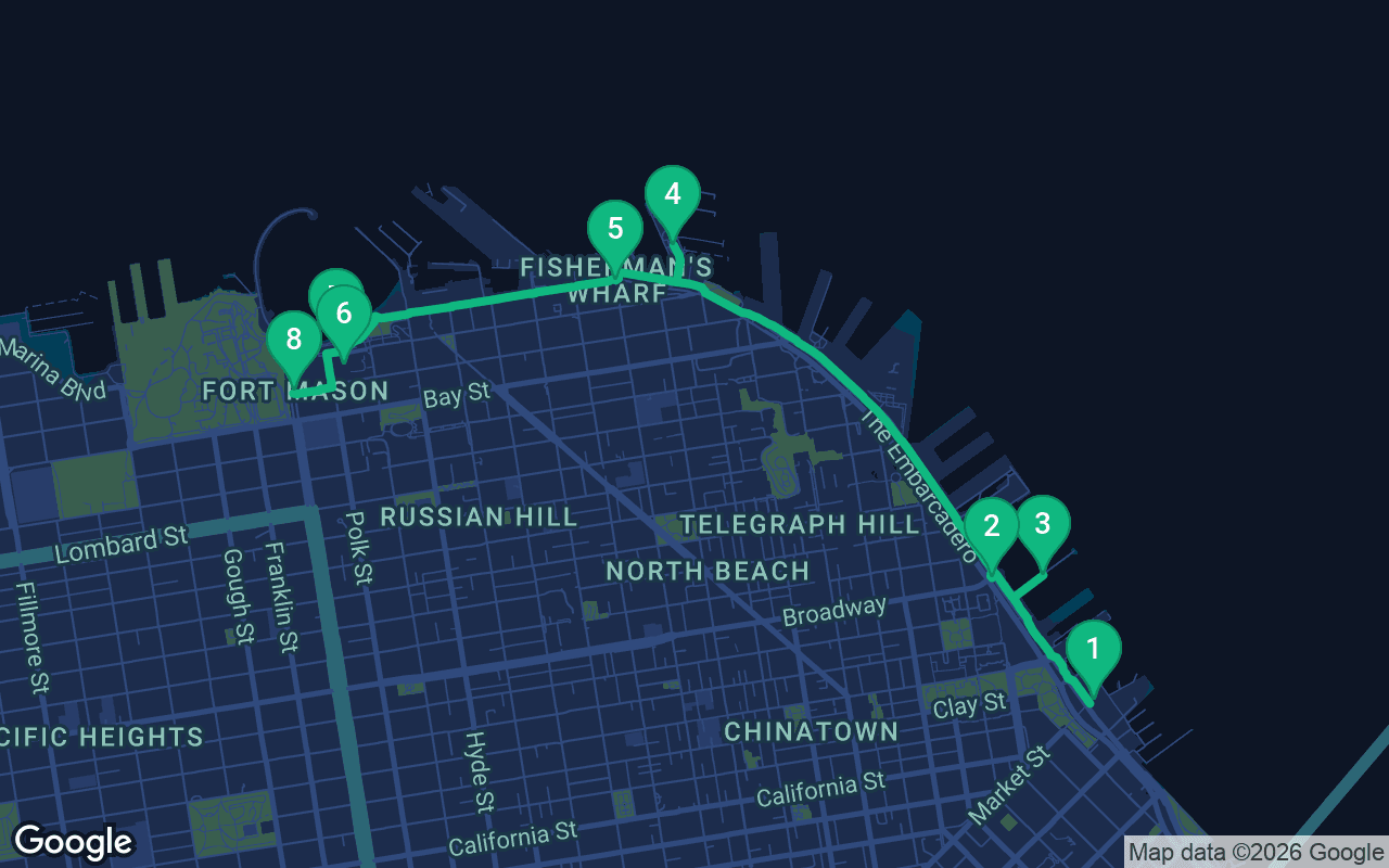
About 4.3 km, roughly 59 minutes at an easy pace.
- 1Ferry Building
- 2Pier 7
- 3Embarcadero
- 4Pier 39Full tour
- 5Fisherman's WharfFull tour
- 6Ghirardelli SquareFull tour
- 7Aquatic ParkFull tour
- 8Fort MasonFull tour
This tour is narrated
Press play on the first 3 stops for a 30-second demo of the narration. In the app, the intro and those 3 stops play in full for free, each one chiming as you arrive. The whole narrated tour is yours for $9.99, a one-time purchase you keep for good.
Works with Garmin, Komoot, Strava, OS Maps and any GPX app.
San Francisco grew up facing the bay. In the Gold Rush, ships crowded the shore so thickly that some were abandoned and buried under the new streets, and for a century afterward the waterfront was a working place of docks, warehouses, ferries and fishing boats. This walk follows that shoreline from the clock tower of the Ferry Building, out along a quiet pier and up the palm-lined Embarcadero to the sea lions of Pier 39, then through Fisherman's Wharf to the old chocolate factory, the swimmers' cove at Aquatic Park and the green bluff of Fort Mason. It is about five kilometers, roughly three miles, and almost entirely flat, one of the easiest self-guided walking tours in a famously hilly city.
Before you set off
Plan for two and a half to three hours at a stroll, more if you eat your way along, which is hard to resist here. The route is flat and paved all the way, apart from a short, gentle climb at the end onto Fort Mason, so any comfortable shoes will do. The waterfront is exposed, and the breeze off the bay can turn cold quickly, especially in summer afternoons when the fog rolls in, so carry a warm layer even if the day starts bright. Mornings are calmest; the Wharf and Pier 39 get very busy from late morning, especially on weekends. The Ferry Building's farmers market runs on certain days of the week, and the museums and historic ships along the way keep their own hours, so check before you go if you want to visit them. Watch for cyclists on the promenade and streetcars on the Embarcadero when you cross. There are plenty of places to sit, eat and use a restroom along the whole route.
Ferry Building
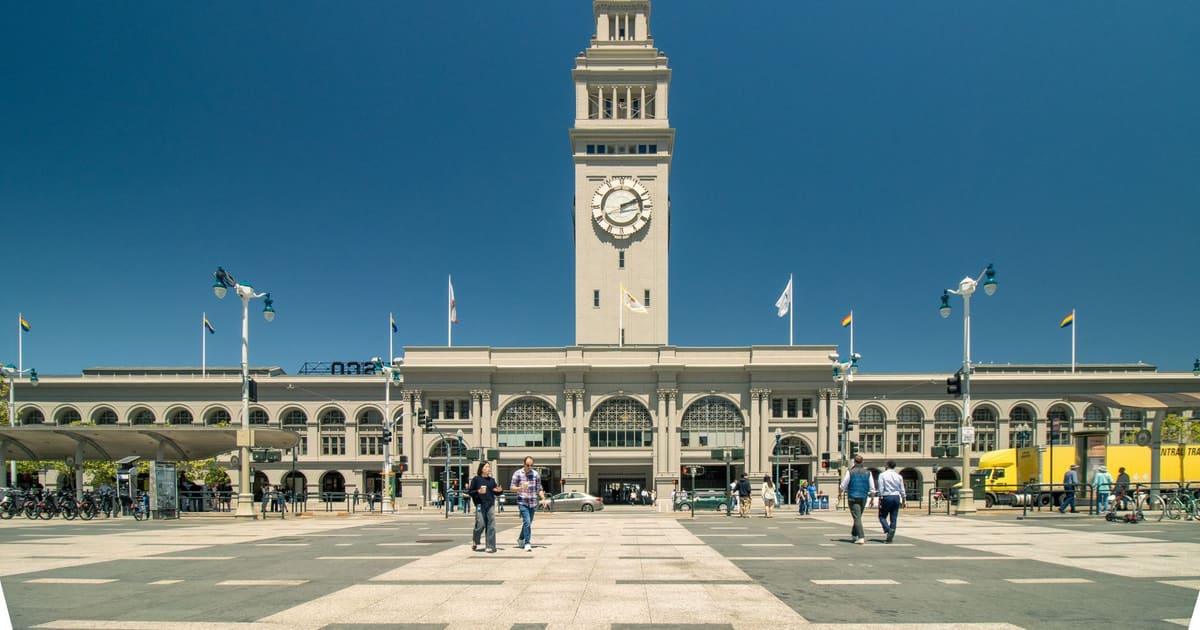
Stand on the plaza facing the bay with the Ferry Building behind you, then turn and look up at its tall clock tower. It was modeled on the Giralda, the cathedral bell tower in Seville, Spain, and when the building opened in 1898 it was the gateway to the city. Before the Bay Bridge and the Golden Gate Bridge opened in the 1930s, almost everyone arriving from the east came by ferry, and tens of thousands of commuters a day poured through this hall, making it one of the busiest passenger terminals in the world. The building survived the 1906 earthquake and fire. Its worst years came later. Once the bridges were built, ferry traffic collapsed, and in the late 1950s a double-deck freeway was built along the waterfront right in front of it, cutting it off from the city. After the 1989 Loma Prieta earthquake damaged that freeway, the city tore it down instead of repairing it, and the Ferry Building was restored and reopened in 2003 as a food hall. Walk through the long central nave under the skylights, past bakeries, cheese shops, oyster bars and coffee roasters. Ferries still leave from the back for Oakland, Sausalito and other towns around the bay. When you are ready, walk north, with the water on your right, along the waterfront promenade past the first few piers for about five minutes, and turn right onto the long wooden pier with old-fashioned lamps.
Pier 7
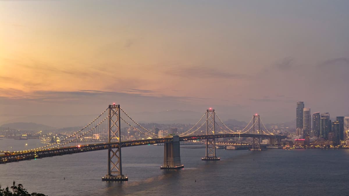
Walk out along Pier 7 as far as you like; it is one of the longest public piers on this waterfront, and one of the most peaceful. There are no shops or restaurants out here, just a wide wooden deck, benches, iron railings and lamps, built for strolling and fishing. You will often see people with rods leaning on the rail, waiting for a bite, and crab nets being pulled up. Look to your right at the huge Bay Bridge stretching toward Oakland. It opened in 1936, six months before the Golden Gate Bridge, and it is much longer, though less famous. The western half is a suspension bridge, while the newer eastern half, beyond the island in the middle, was rebuilt after a section collapsed in the 1989 earthquake. That island is Yerba Buena, which is natural, joined to Treasure Island, which is not; it was built from fill dredged from the bay for a world's fair in 1939. Now turn around and look back at the city. From here you can see the shape of the waterfront: the skyscrapers of the Financial District, the narrow white Transamerica Pyramid and, on top of the green hill to the northwest, the slender column of Coit Tower. When you are ready, walk back to the start of the pier and stand at the edge of the wide boulevard, about three minutes.
Embarcadero
 You are on the Embarcadero, the broad boulevard that curves along San Francisco's waterfront. The name means landing place in Spanish. Look down the middle of the road at the tall palm trees and the streetcar tracks. Until the early 1990s, all of this lay in the shadow of that double-deck freeway. When it came down, the city planted these palms and laid tracks for the F line, a streetcar service that uses vintage trams from around the world. Watch for them as they pass, painted in the colors of the cities where they once ran, including old cars from Milan, with wooden seats inside. The piers here have odd numbers north of the Ferry Building and even numbers to the south. Behind the piers runs a seawall, built from the 1870s onward, and much of the land you see between here and the hills is filled-in bay. During the Gold Rush, crews abandoned their ships here to go and dig for gold, and some of those ships were used as stores and lodging, then buried as the shoreline was filled in. Remains of several have turned up beneath downtown buildings. Now set off northwest along the waterfront promenade, with the water on your right. This is the long leg of the walk, about twenty to twenty-five minutes, past the science museum at Pier 15, the cruise terminal and the boats to Alcatraz, until you reach a busy pier with a carousel.
The full tour continues in the app
- Distance
- 4.3 km
- Walking
- 59 min
- Steps
- ~6,000
- Narration
- 15 min
What's included
- All 8 stops, fully narrated
- Works offline once downloaded in the app
- Friends walk free one purchase covers everyone on your walk
Our tours are made to be meditative and immersive: you keep moving and simply listen. They're always better together, and the app plays the narration in sync, so you, your partner and your friends hear every stop at the same moment.
Pier 39
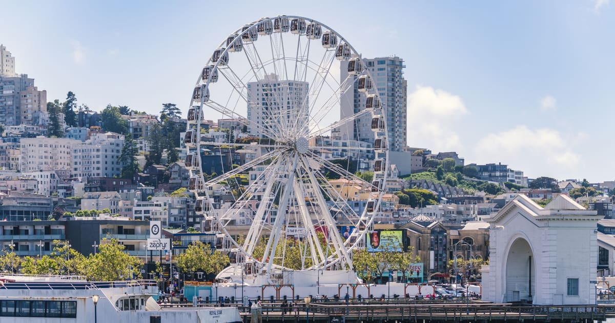
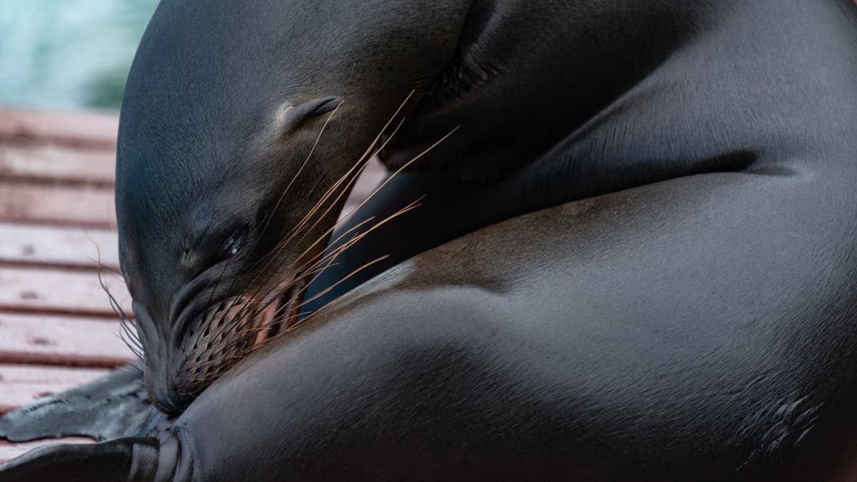
Pier 39 is the liveliest and loudest place on the waterfront, a two-level wooden village of shops, restaurants and street performers built over an old cargo pier. It opened in 1978, but its most famous residents arrived on their own.
The rest of this stop is in the full audio tour.
Fisherman's Wharf
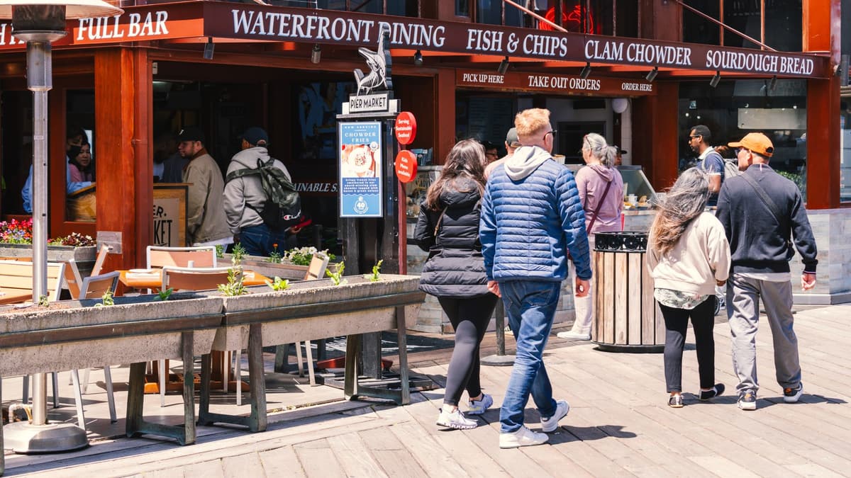
Find the round sign with the crab in the middle, at the corner of Jefferson and Taylor Streets, and look around. This is Fisherman's Wharf, and it really was a fishing harbor.
The rest of this stop is in the full audio tour.
Ghirardelli Square
You are at Ghirardelli Square, a group of red brick buildings on the slope above the bay, crowned by a big sign that spells out the name of a chocolate company.
The rest of this stop is in the full audio tour.
Aquatic Park
You have reached Aquatic Park, a small curved beach facing a calm cove, sheltered by a long pier that bends around it like an arm. Behind you stands a white building with rounded corners and railings like the deck of a ship.
The rest of this stop is in the full audio tour.
Fort Mason
You are on the green bluff of Fort Mason, and the view opens up across the bay to the Golden Gate Bridge, the Marin hills and Alcatraz. Spanish soldiers placed a small gun battery on this point in the 1790s.
The rest of this stop is in the full audio tour.
Do this walk with other people on the next scheduled tour.
About 4.3 km, roughly 59 minutes at an easy pace · 8 stops
Friends walk freeMore audio tours in San Francisco
$15.99Turning Points $9.99City Highlights
 $6.99City Highlights